KHORAT GEOPARK
Name
The name “Khorat Geopark” arises from the former name of Nakhon Ratchasima Province, Khorat (also known as Korat), before the capital was moved from Sung Noen District to the present location by King Narai the Great in 1674 (Buddhist Era, BE 2217). Khorat has been renowned nationally for the Khorat language, people, music and internationally recognized in scientific names of new vertebrate fossil species discovered in the geopark, e.g., Khoratosuchus jintasakuli (crocodile) and Sirindhorna khoratensis (dinosaur).
Logo
Pictures of Khorat Geopark natural identities are incorporated into its logo, including the ancient elephant (Gomphotherium), the cuesta topography, and the Lam Takhong River.
**(please click right on each picture, and open in the new tab to get higher resolution)**
Location
Latitude 14°40’48” N - 15°08’24” N
Longitude 101°23’46” E - 102°23’53” E

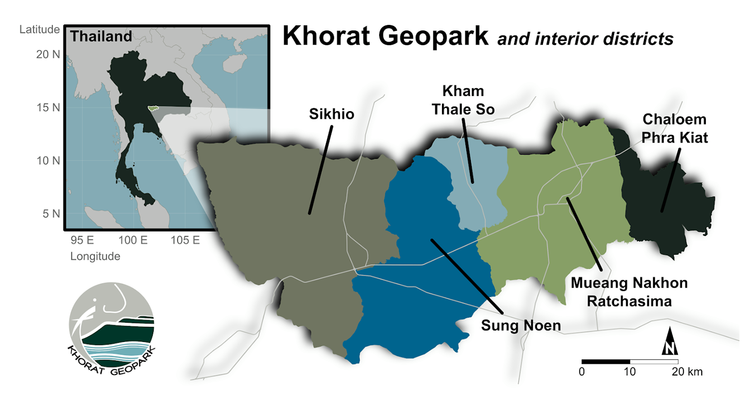
Picture 1 Location of Thailand in South-east Asia (left)
(UNESCO: http://www.unesco.org/new/fileadmin/MULTIMEDIA/HQ/SC/images/UGG_South_Asia_Map.jpg
Picture 2 Khorat Geopark and interior districts (right)
Surface Area
3,167.38 km2
15.22% of Nakhon Ratchasima Province
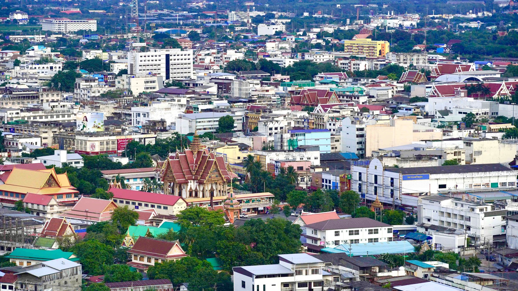
Picture 3 Nakhon Ratchasima town
Physical & human geographic characteristics
Most of the Khorat Geopark is composed of the lower to middle Lam Takhong Basin ranging from 130 - 760 meters above mean sea level.Geographically, there are 3 distinct zones:
1) The mountainous areas and cuesta hills in the west and southwest of the geopark
2) The central and eastern undulating terrain
3) The northern plains
The Khorat Geopark has 3 distinct seasons: the dry season (November to February), summer (February to May) and the rainy season (May to October). The average annual temperature is 27.4 °C, ranging from 22.7 °C - 33.0 °C. The average rainfall throughout the year is 1,019.2 mm and the highest rainfall is in September (maximum 202.3 mm).
Land use in the geopark is primarily agricultural (67.96%), including cassava, sugarcane, corn, and rice. Communities and towns make up 12.57% of the area and forests cover the remaining 12.04%. The human population in the Khorat Geopark in 2018 was estimated at 741,239 people with a population density of 234 people per square kilometer (Department of Provincial Administration, Ministry of Interior, 2018).
The forested areas are primarily dry dipterocarp forests, a forest type which is endemic to the south and south-east Asia, along with fragmented patches of dry evergreen forest scattered in areas at higher altitudes, especially on cuestas.
Picture 4 Lam Takhong Basin, viewpoint from
About Khorat Geopark
Khorat Geopark was established as a Provincial Geopark in 2015 by the governor of Nakhon Ratchasima Province, Mr. Thongchai Lue-adul, and a Board of Directors and Administrative Committee were appointed. The Khorat Geopark Office was established in 2016 at the Northeastern Research Institute of Petrified Wood & Mineral Resources as a center of administration by Mr. Wichian Chantharanothai, the current governor of Nakhon Ratchasima Province, in order to cooperate with the network in 5 districts. Khorat Geopark was established as a National Geopark of Thailand in August 2018 by the Ministry of Natural Resources and Environment.
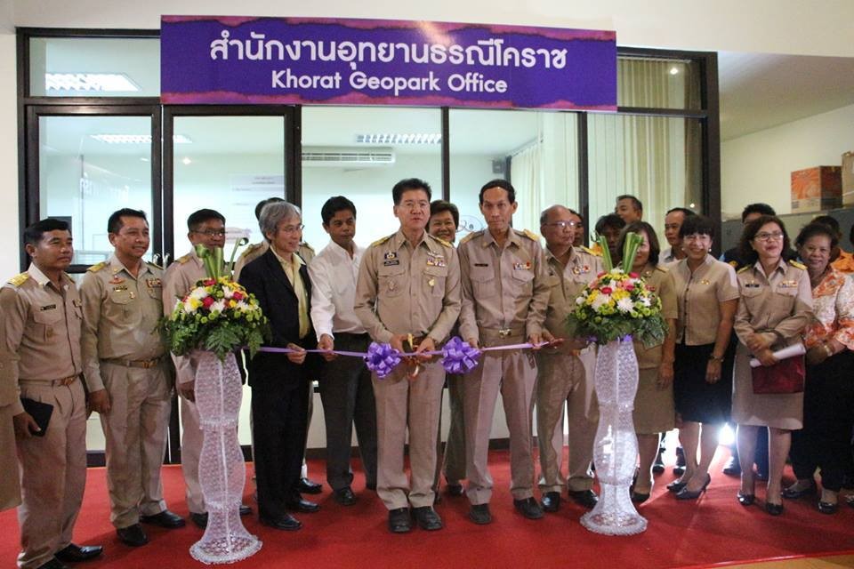
Picture 5 Khorat Geopark Office open ceremony by Nakhon Ratchasima governor, Mr. Wichien Chantaranothai (left).
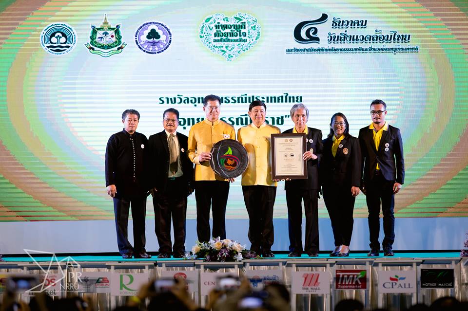
Khorat Geopark boards received the certificate and the logo of National Geopark of Thailand from a minister of the Ministry of Natural Resources and Environment on Dec 4, 2018 (right).
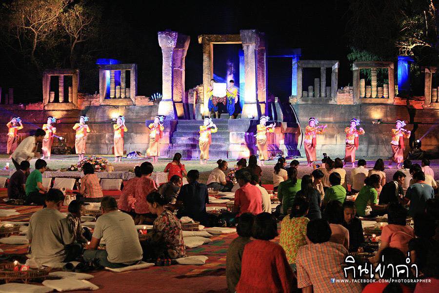
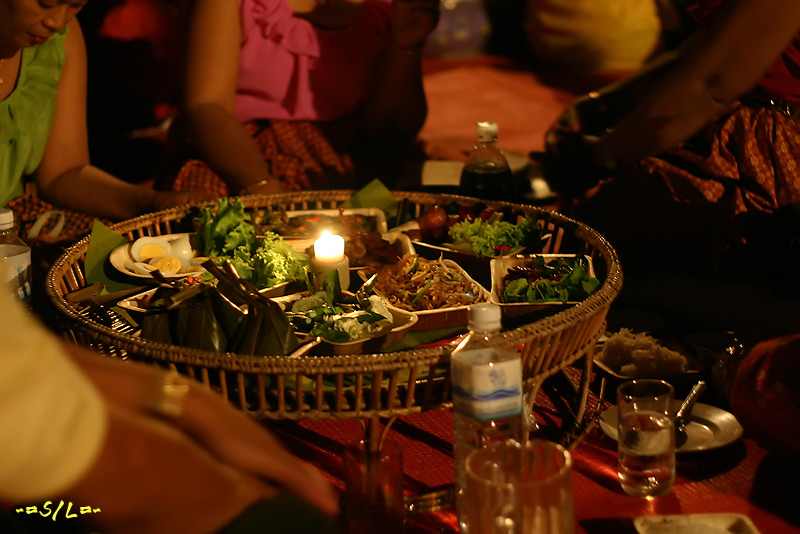
The mission of the Khorat Geopark under the guidelines of UNESCO is management with a holistic concept of conservation, education and sustainable development, with significant involvement of local communities in tourism activities related to geology or world geography. These activities cover both geological sites, as well as ecological and cultural sites related to geological sites. An example is the tradition of Kin Khao Kham (eating dinner together in Khorat dialect) at Sung Noen District, held at Muang Khaek Stone Sanctuary. This sanctuary was built from a sandstone quarry or a sandstone hill.
Picture 6 Muang Khaek Stone Sanctuary, Sung Noen District (left)
Picture 7 The tradition of Kin Khao Kham (eating dinner together in Khorat dialect) at Muang Khaek Stone Sanctuary (right)
.jpg)
Picture 8 Thai dance dinner show at the tradition of Kin Khao Kham festival. (left)
Picture 9 The tradition of Kin Khao Kham (eating dinner together in Khorat dialect) held at Muang Khaek Stone Sanctuary.
Photo Credit : http://www.koratstartup.com/sungnoen-dinner-fes59/
The Khorat Geopark can be identified as the Gateway to the Khorat Plateau, covering the middle to lower part of Lam Takhong River Basin, The unique landscape of the Khora Geopark area is the series of sandstone cuesta or E-to (cleaver knife) mountains and the antecedent stream, Lam Takhong that flowed through and carved out by erosion the sandstone bedrock.
The unique geological feature of the region is the diversity and abundance of fossils. A large number and high diversity of types of dinosaurs and associated animal fossils have been found in calcareous conglomerate rock alternating with sandstone in Mueang District, Ancient elephants, associated animal fossils, and petrified wood occur in sand and gravel deposits in Chaloem Phra Kiat and Mueang districts of Nakhon Ratchasima. Therefore, it can be said that Khorat is the Paleontopolis (City of Ancient Life) of the world. Furthermore, in terms of ecology, deciduous dipterocarp forests are the dominant forest type in the area. Moreover, the culture of the area that is unique and different from any other Global Geopark, is Thai Khorat Cultura. Therefore, when thinking of Khorat Geopark, it is worth remembering it as “The land of 1 mountain, 1 stone, 1 forest, 1 river 1 culture and 3 fossils”, which will be further explained below.
Picture 10 The Gateway to the Khorat Plateau and Lam Takhong River Basin
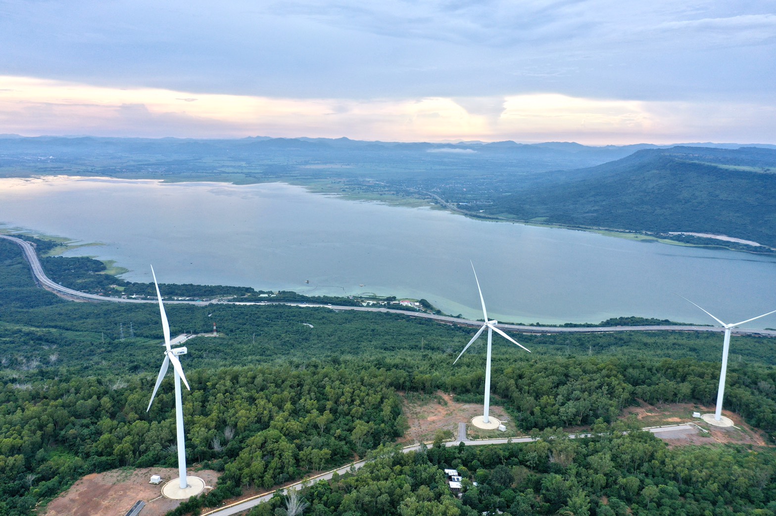
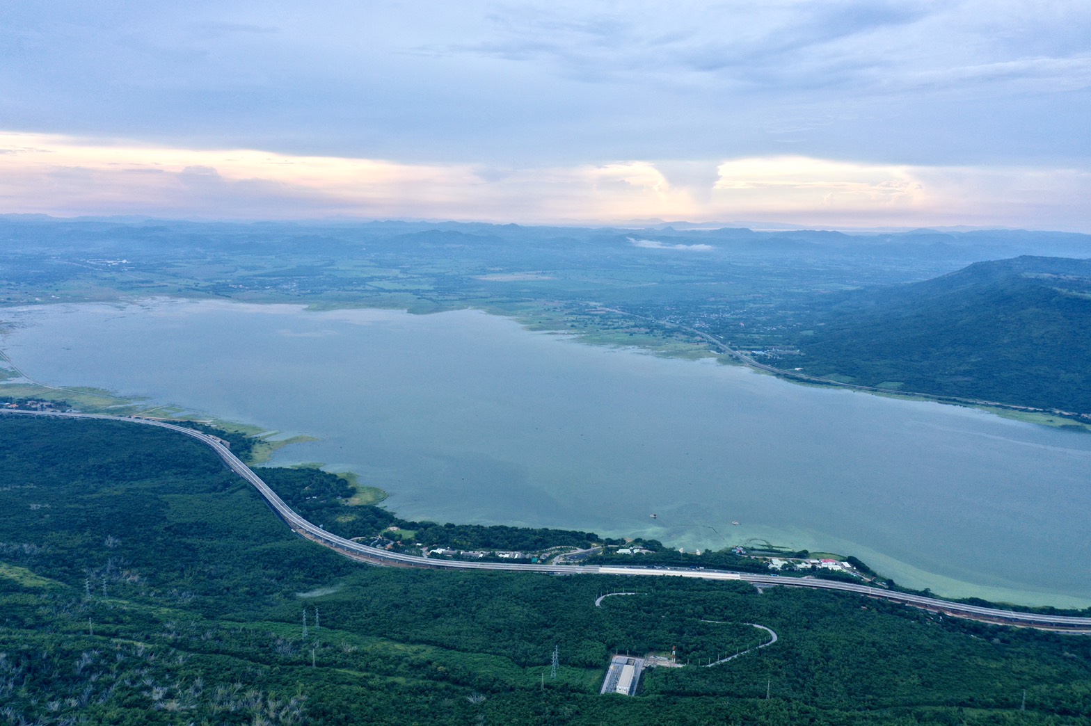
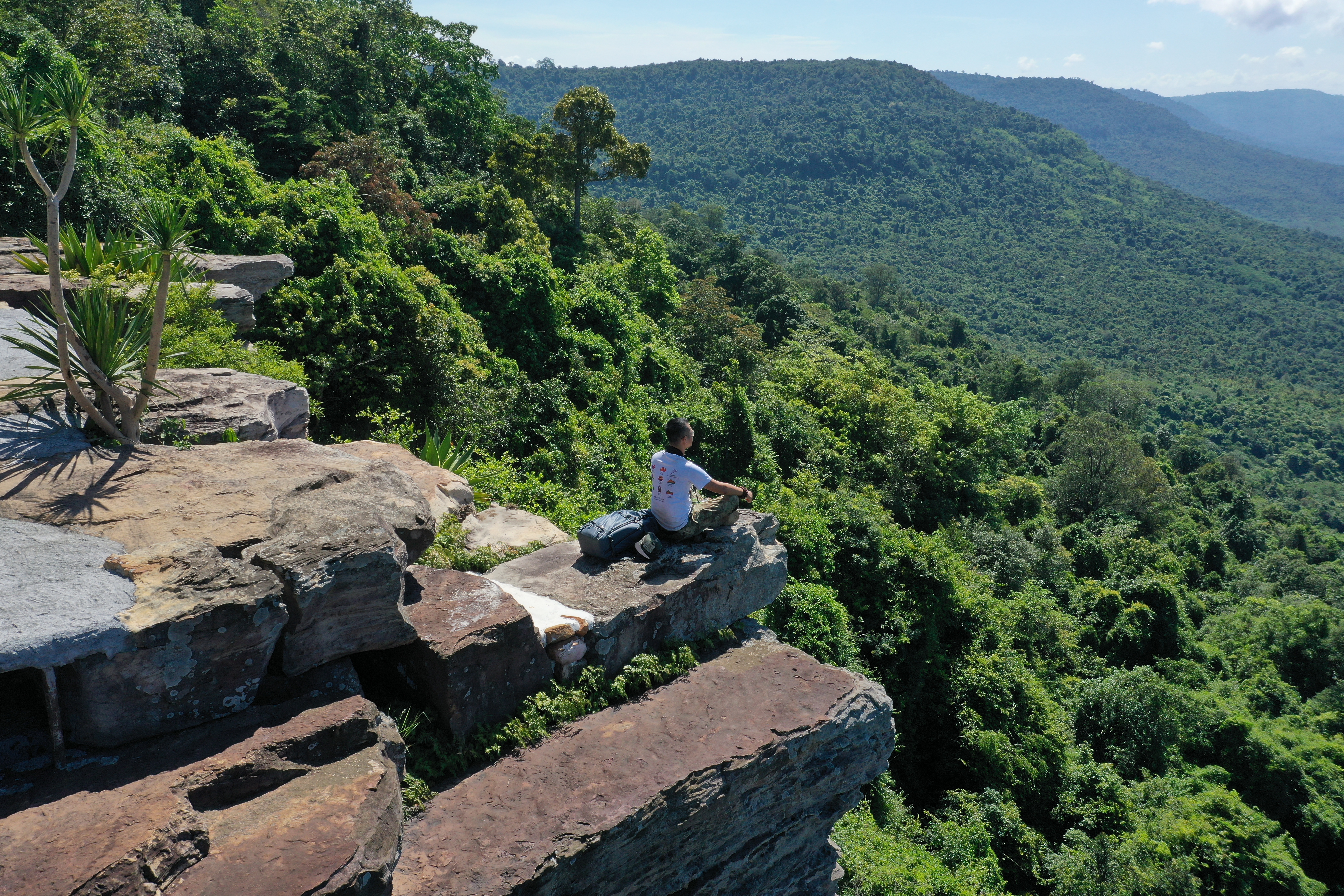
Travelling from Central of Thailand, passing Pak Chong District, and entering the true Gateway to the Khorat Plateau, one inevitably passes through a valley between Yai Thiang Mountain and Khananjit Mount. Through this valley passes Mittraphap Highway a railway, a gas pipe, and Lam Takhong River. Also, the Lam Takhong Dam was built at this location, supplying water to more than seven hundred thousand inhabitants of the Khorat Geopark. The viewpoints on Yai Thing Mountain near the upper reservoir and Yai Thiang Cliff are sites
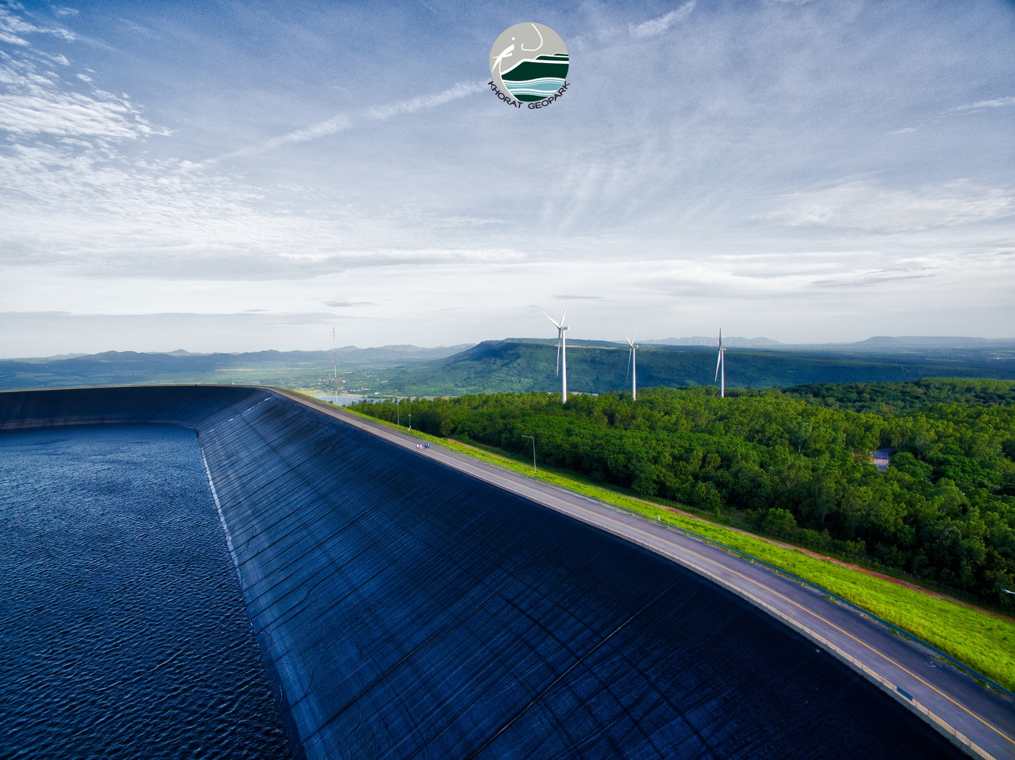
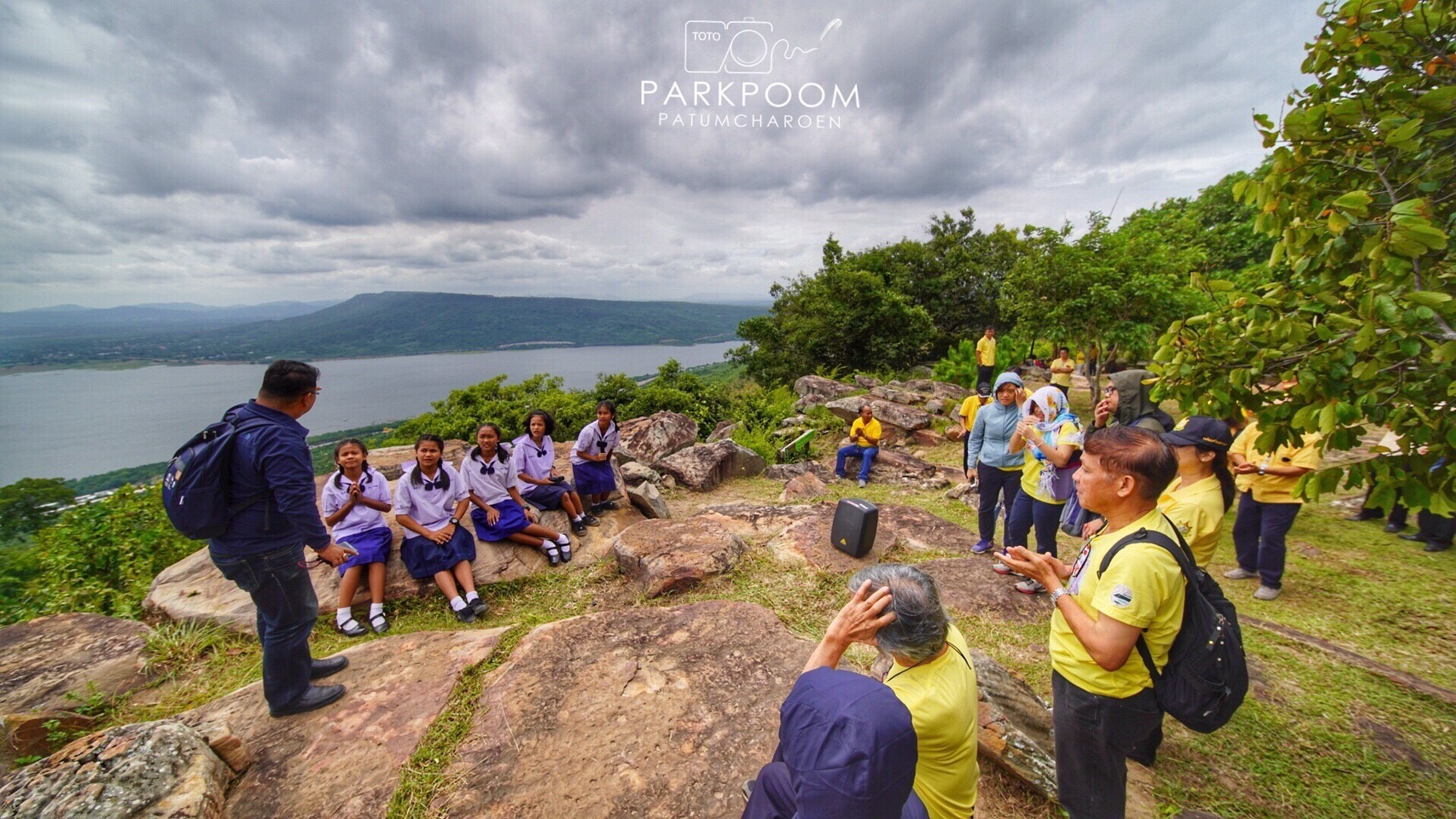
Picture 11 The upper reservoir, Lamtakong Jolabha Vadhana Hydro Power Plant Electricity Generating
Picture 12 Yai Thiang Cuesta or E-to (cleaver knife)
where one can see steep north-facing cliffs of the Khorat Plateau, where it was divided into sandstone cuestas or E-to (cleaver knife) mountains, overlying each other. One can also see a gentle westward sloping caused by the tilting of the rock layers, resembling Khao Phra Wihan in both rock types and terrain. In geological terms, these layers of rock are referred to as the the Phra Wihan rock formation. These rocks are highly resistant to erosion and have remained as a mountain with a steep face and a gently sloping side, with an altitude of 400 – 700 meters above mean sea level. Meanwhile, Limestone Mountains with jagged cliffs, caused by dissolution from rain water, can be seen in the west in Pak Chong and Muak Lek districts. The way of life of people living in these two areas are different.
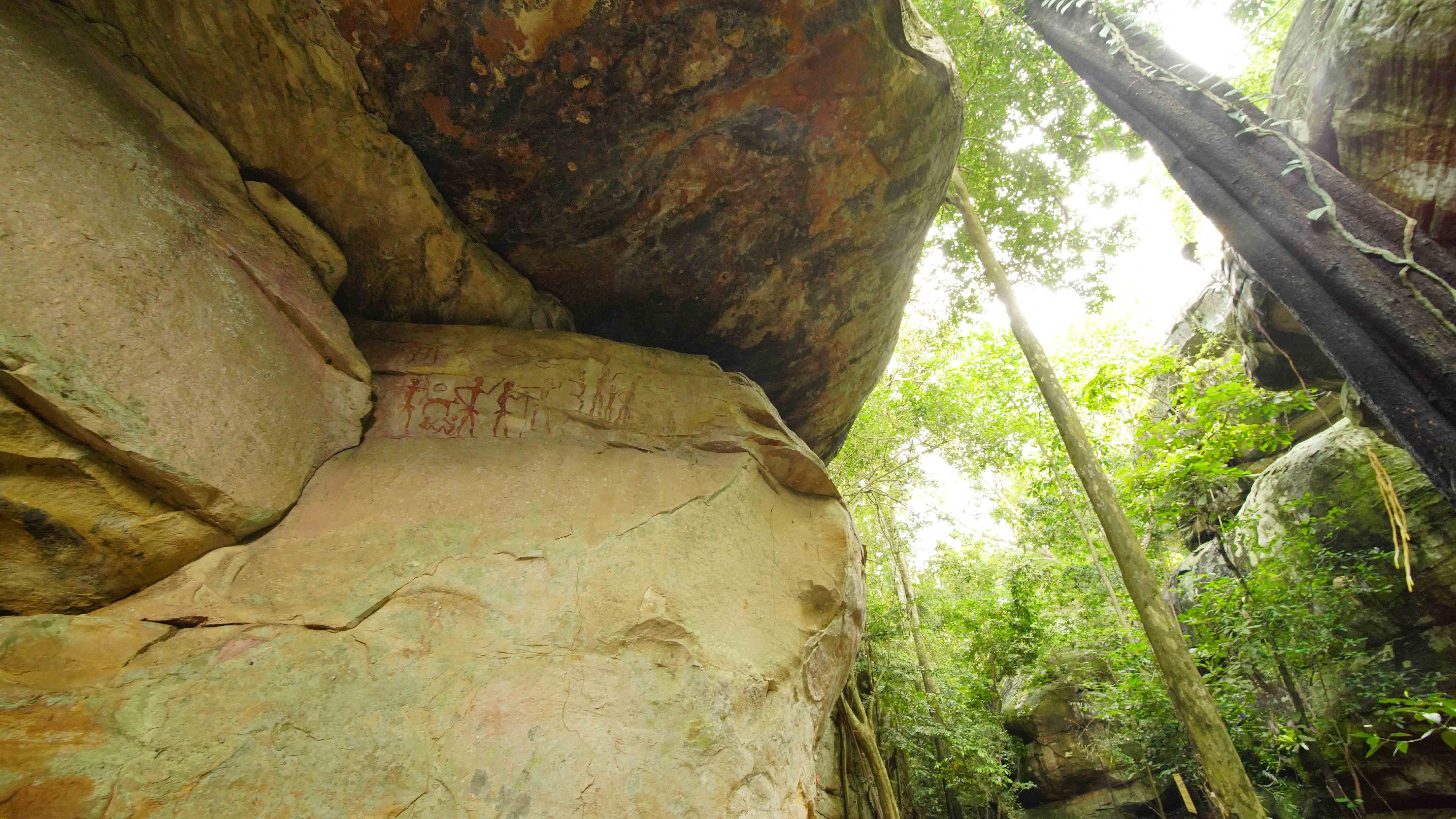
Picture 12 Khao Chan Ngam Cave and Prehistoric Paintings
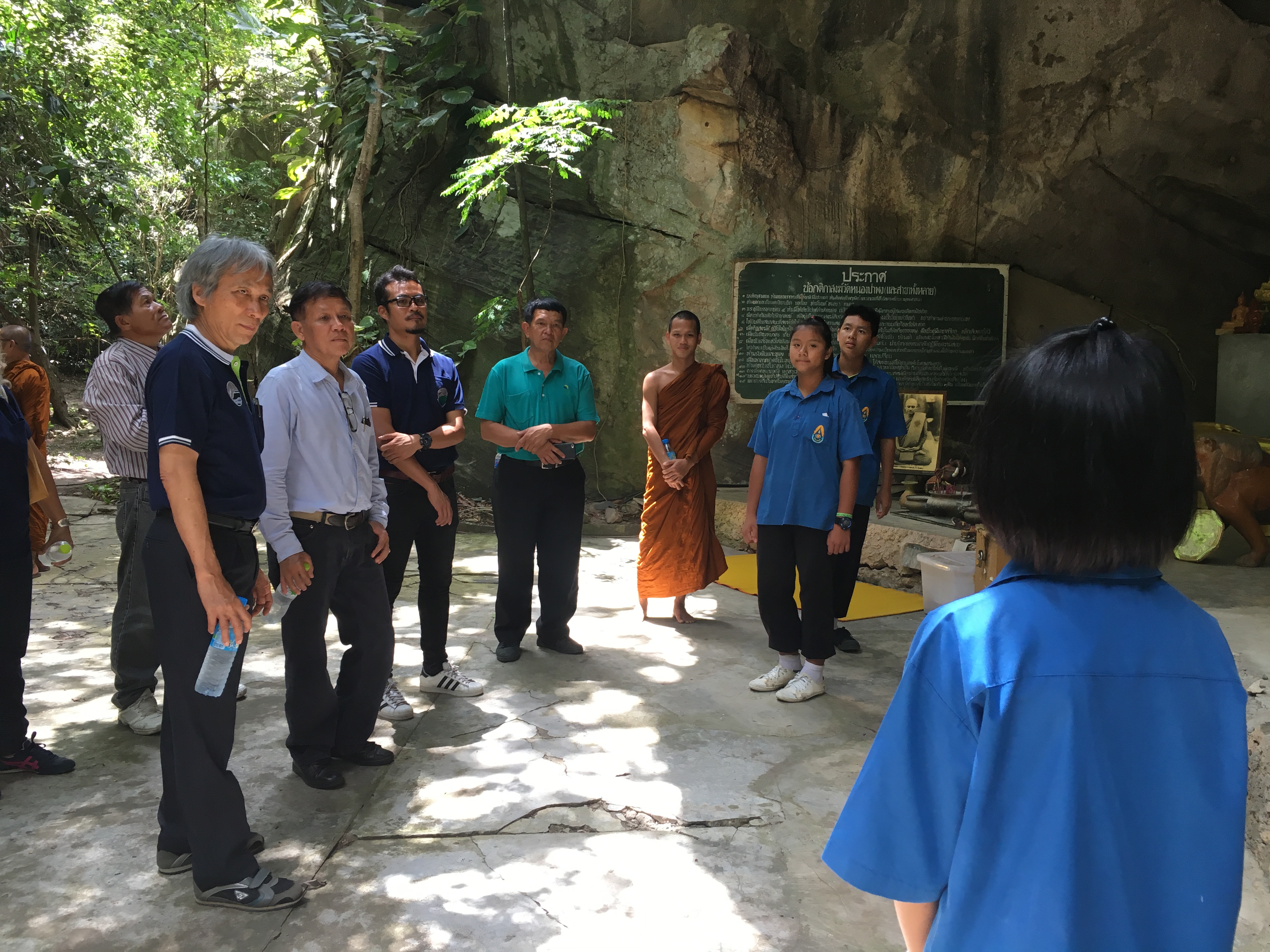
Passing through the Gateway to the Khorat Plateau along Friendship Highway to the eastward sloping area in Khlong Phai Subdistrict, there is the source and sale of local sandstone products, the largest such area in Thailand. At another site along the eastern sloping hill, there are outcrops and overhanging cliffs of sandstone called Khao Chan Ngam Cave, with prehistoric color paintings made by Khorat inhabitants approximately 3 to 4 thousand years ago. These paintings show the hunter-gatherer lifestyle and Stone Age rituals. Along a long ridge to the southeast, the top of the cuesta reaches a height of more than 700 meters and is the site of a beautifully decorated temple (Wat Pa Phu Pha Sung) with a large pagoda. Here there is an ongoing effort to conserve the environment close to the natural state.
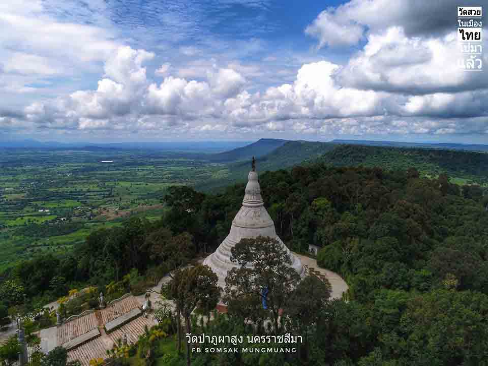
Picture 13 Wat Pa Phu Pha Sung (left)
Picture 14 Sikhio Sandstone Historical Quarry (right)
From the sloping edge of the Khorat Plateau, across the undulating plains, to the easternmost plains of the Khorat Geopark, the dominant ecosystem is deciduous dipterocarp forest. The dominant trees are dipterocarp trees, Shorea obtusa, Shorea siamensis, Dipterocarpus tuberculatus, Dipterocarpus obtusifolius, and, Dipterocarpus intricatus, along with hundreds of other plant species. There are two important tourism learning centers in the Khorat Geopark, the Center for the Conservation of Genetic Resources, at Khlong Phai, Sikhio District, and the Center for the Conservation of Genetic Resources, at Nong Rawiang, Mueang District, Nakhon Ratchasima.
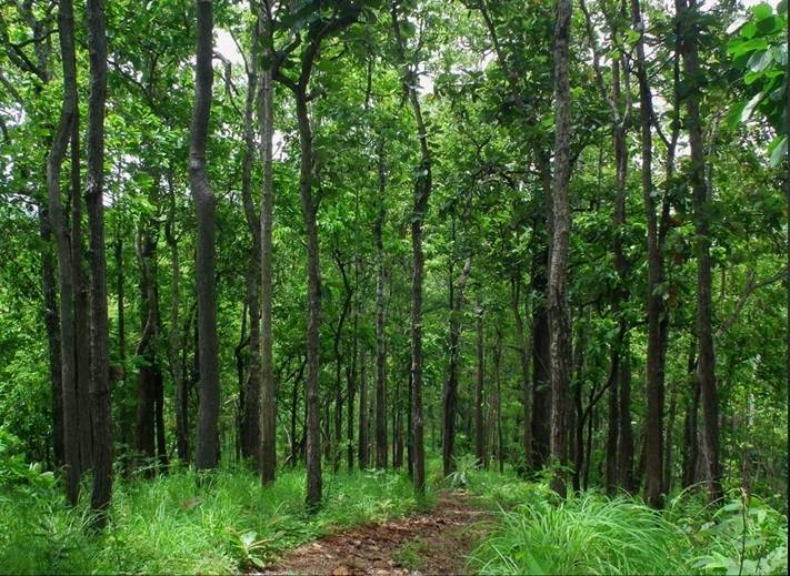
Picture 15 Deciduous Dipterocarp forest in Khorat Geopark area .
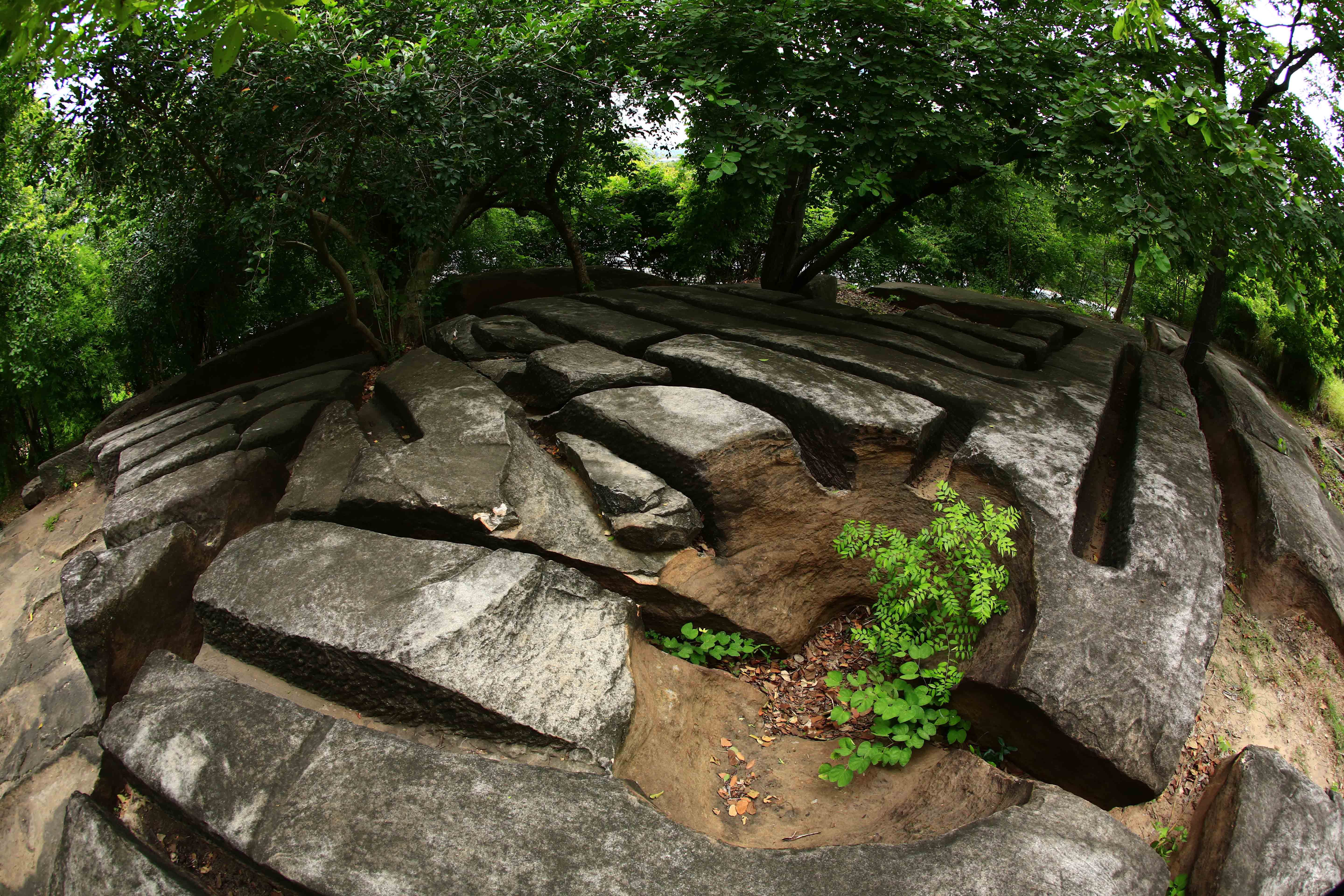
Approximately 10 kilometers east of the margin of the Khorat Plateau is another row of cuestas parallel to the first row of cuestas and isolated as hills of resistant sandstone. The age, morphology, and characteristics of the rocks resemble those of the Phu Phan range in Kalasin Province; therefore, these rock layers are referred to as part of the Phu Phan Formation. One of these hills is the closest source to ancient communities along the Lam Takhlong and Mun rivers of building rocks as shown by the evidence of stone cutting in sandstone quarries. The rocks, in Mittraphap Subdistrict, Sikhio District, were used in the construction of sandstone sanctuaries over one thousand years ago. Additionally, there are geological features resulting from the flow of water down these hills, namely, potholes, or “Kumphaluk” in Thai. Hundreds of potholes are present ranging from small to large holes, with diameters greater than 2 meters. These potholes can also be seen in other cuestas in the same range, such as at Khao Sam Sib Sang in Makluea Kao Subdistrict, of Sung Noen District.
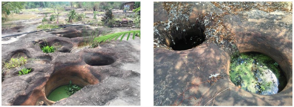
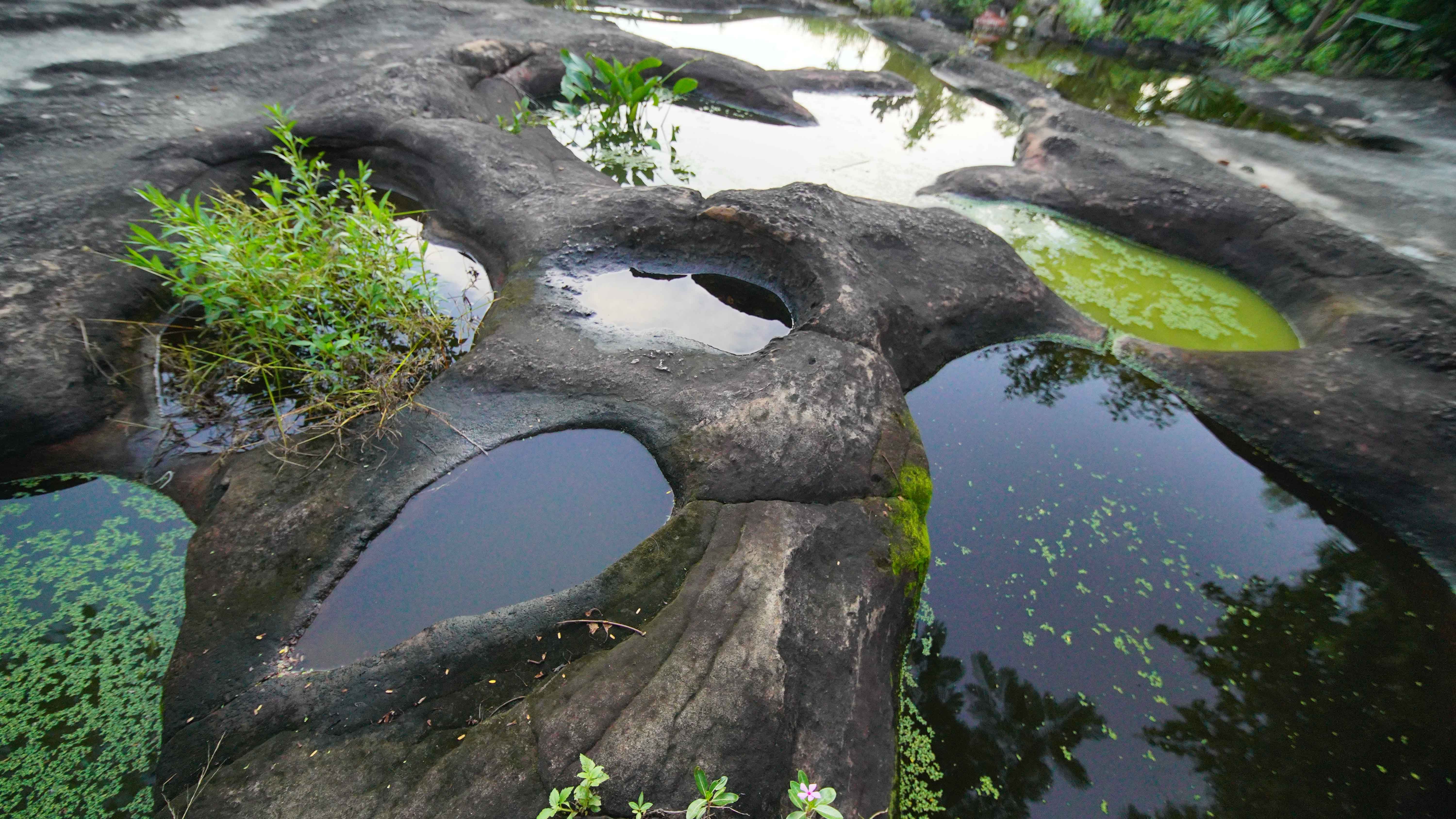
Picture 16 "Potholes" or “Kumphaluk” in Thai, at Khao Sam Sib Sang in Makluea Kao Subdistrict, Sung Noen District.
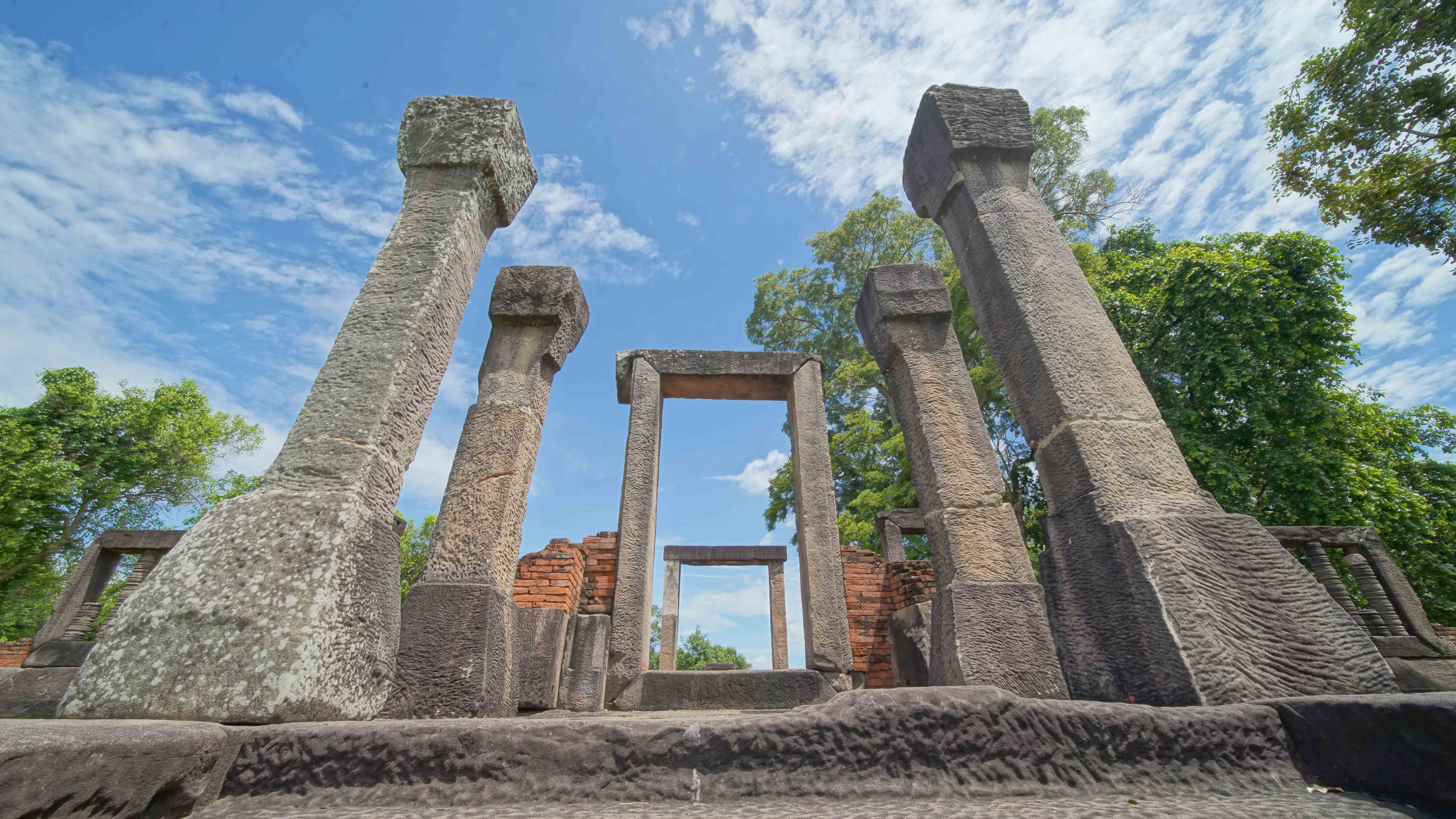
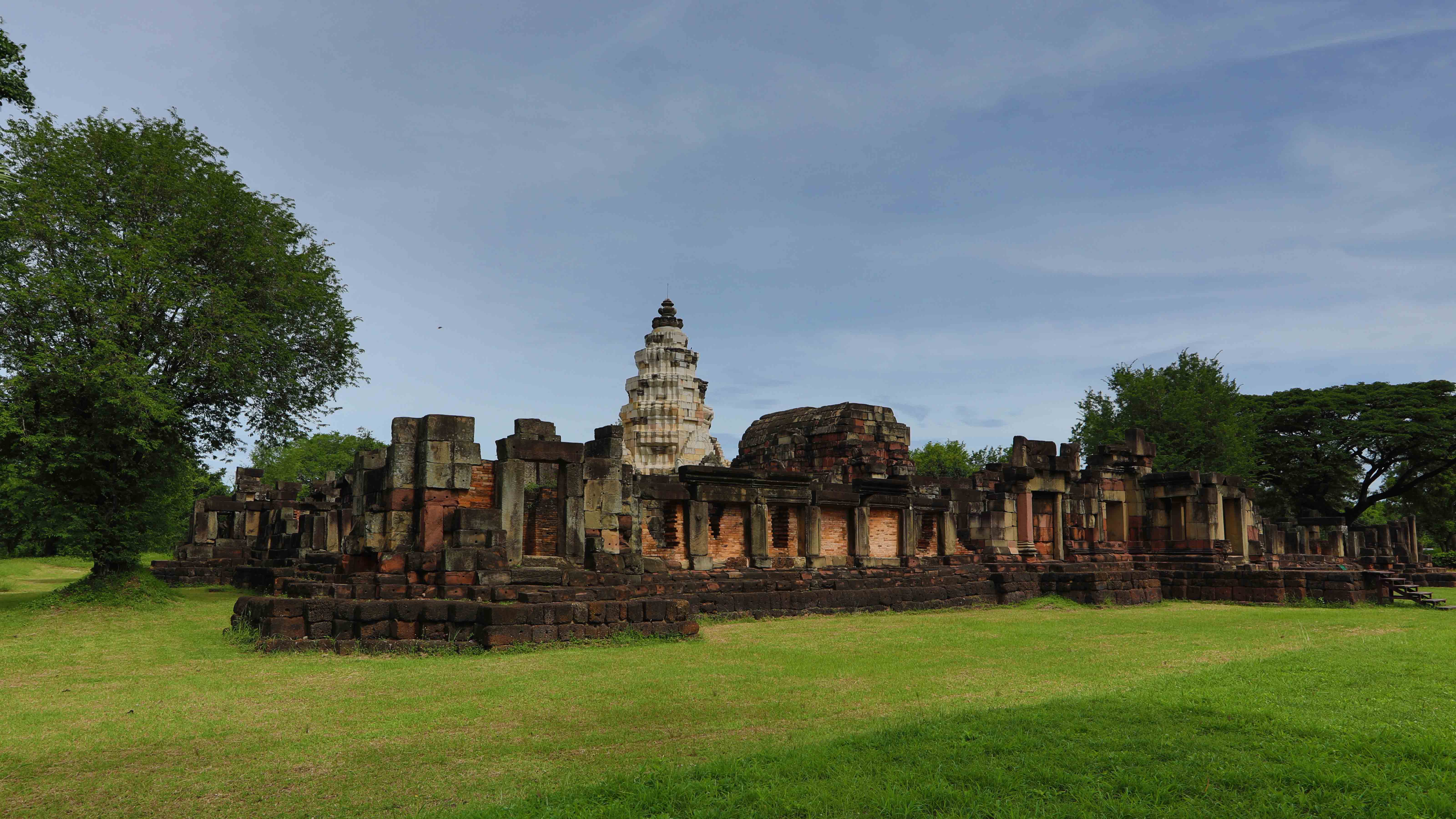
An ancient community along the Lam Takhong River approximately 1,300 years ago was a Buddhist community of the Dvaravati Period. There is evidence for the moated city Mueang Sema. The oldest sandstone Reclining Buddha in Thailand, sandstone wheels of dharma, and Bai Sema (Thai temple boundary stones) carved from sandstone were built outside of Mueang Sema. This city is thought to have been the center of the Sri Canasapura kingdom. There is evidence that later, approximately 1,000 to 800 years ago, Mueang Khaek Stone Sanctuary–Non Ku–Mueang Kao was built at Korat Subdistrict, in Sung Noen District. Mueang Khaek Stone Sanctuary was a Hindu or Brahman religious complex built from sandstone and bricks. The site was used for ritual offerings to Shiva. At present, “Kin Khao Kham” (traditional dinner) fair is held annually.
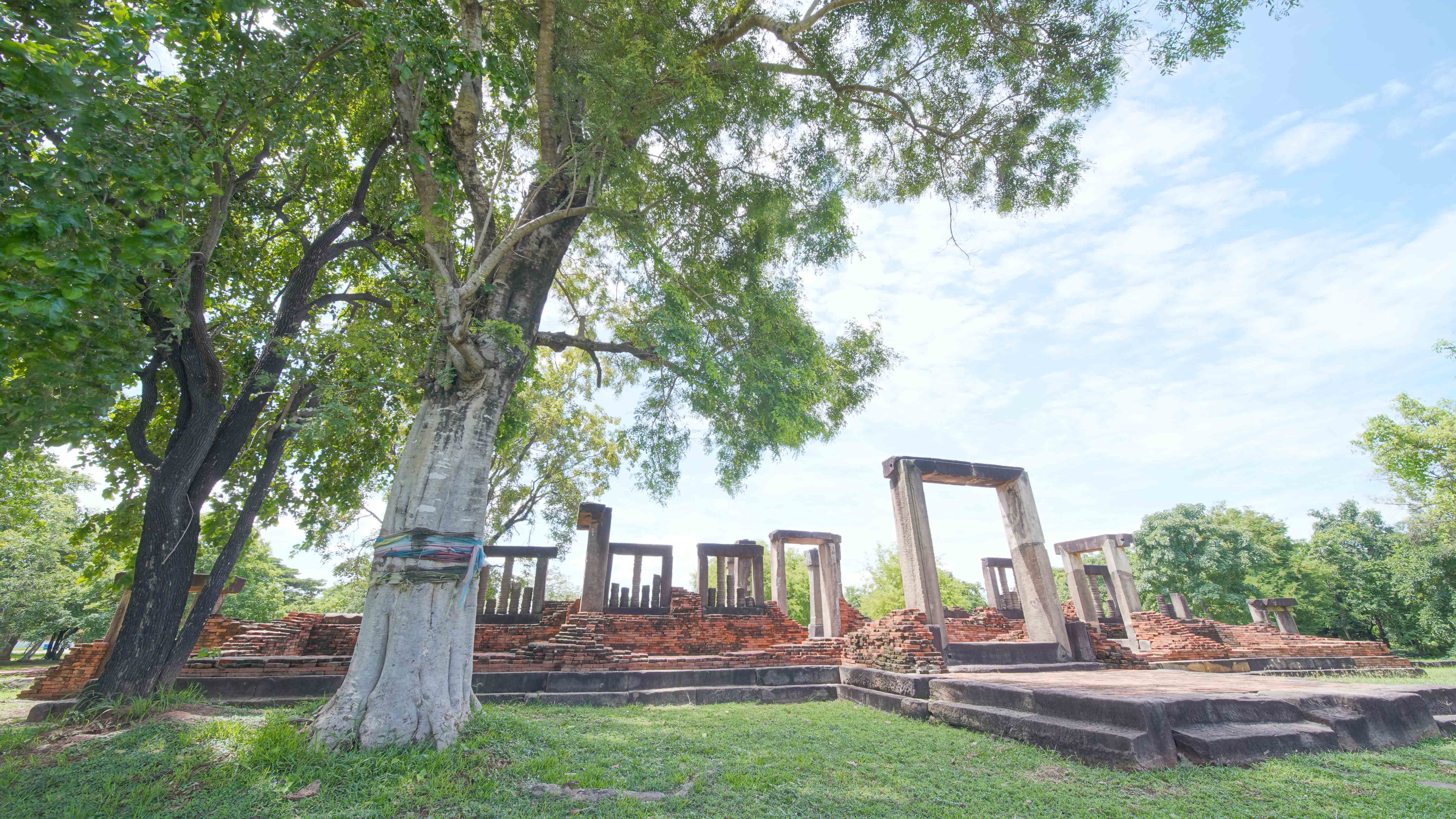
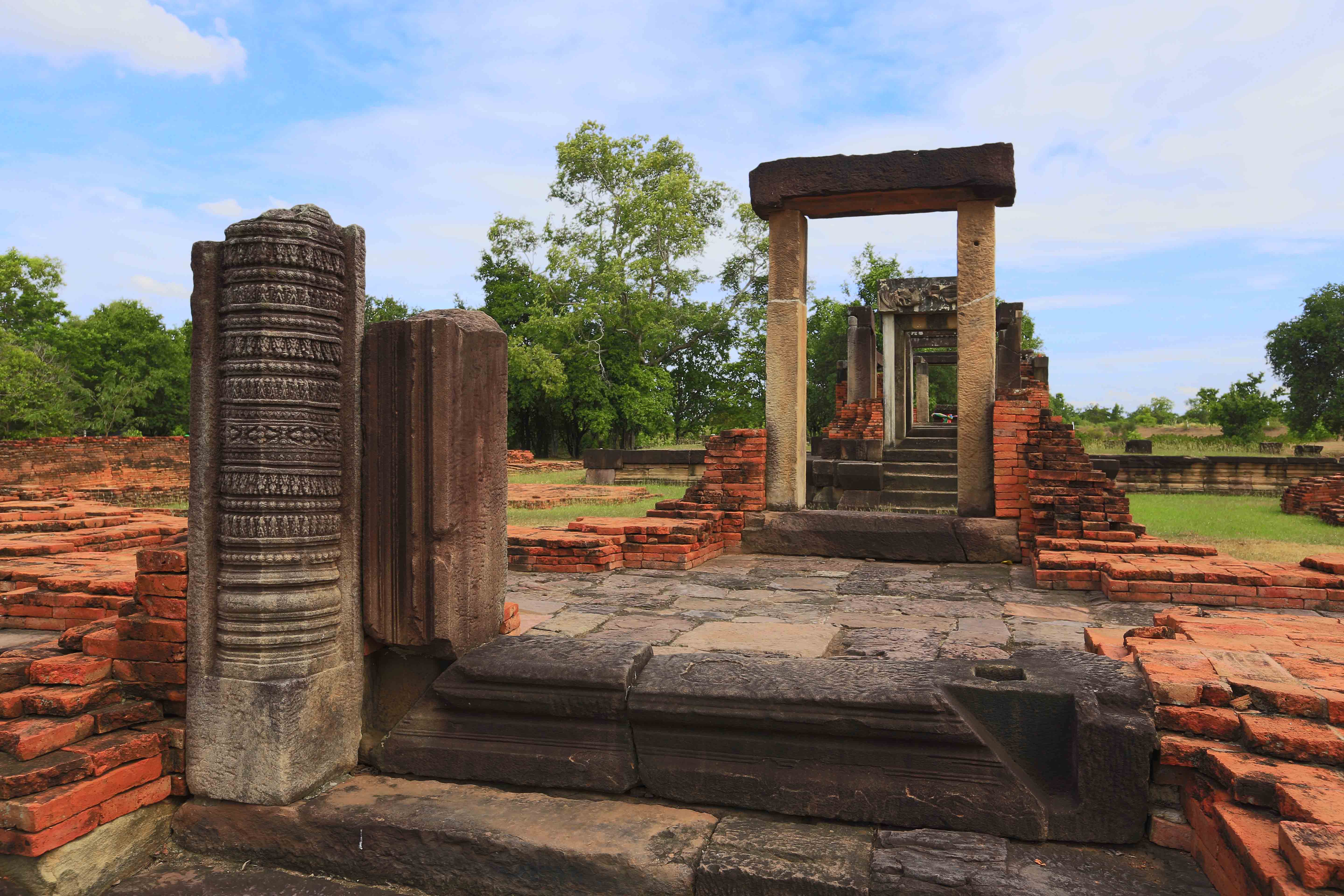
Picture 17 Mueang Khaek Stone Sanctuary, Sung Noen District
Many waterfall tourist attractions in the geopark are available due to the presence of both resistant and nonresistant sandstone layers. The waterfalls often have flowing water only during the rainy season, such as Wa Phu Kaew Waterfall at Makleua Mai Subdistrict. Exceptions can be found in the Lam Takhong watershed, such as Wang Nen at Makleua Kao Subdistrict, which is the most visited and attractive waterfall for Nakhon Ratchasima residents. With proper environmental management and with local community participation and cooperation from all related sectors, this place will be a standard and sustainable tourist attraction.
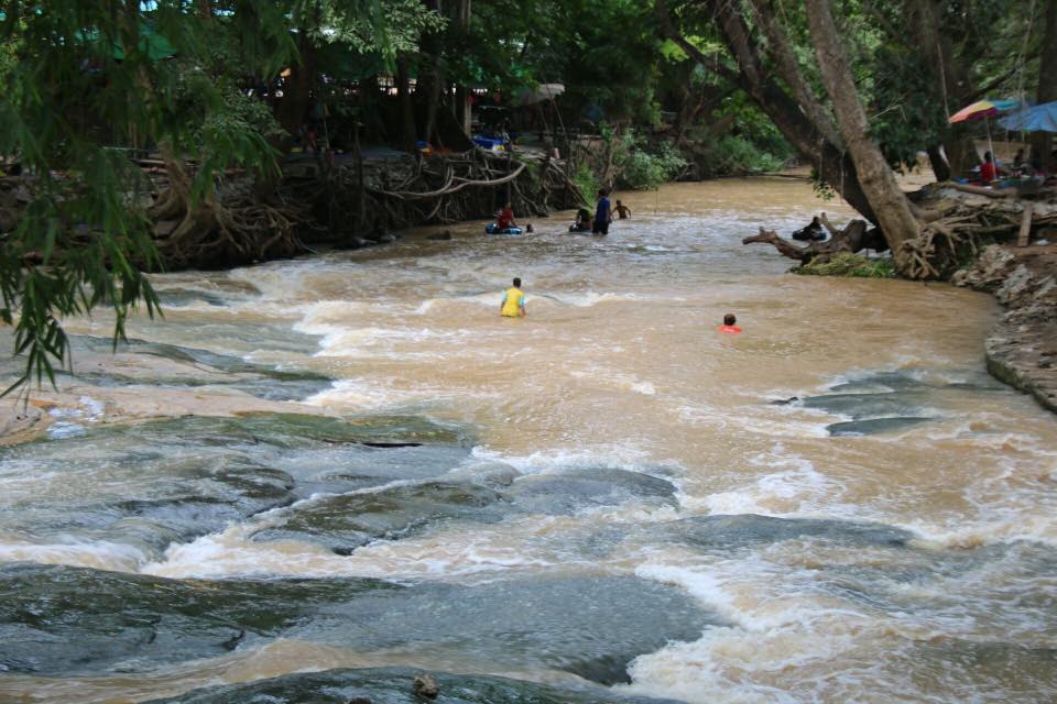
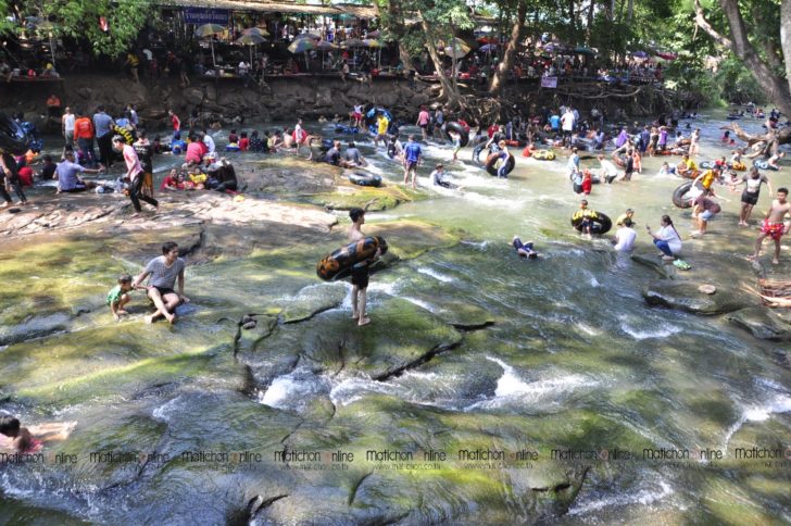
Picture 18 Wang Nen Waterfall, Sung Noen District
Photo Credit : https://www.matichon.co.th/region/news_116132b (right)
Photo Credit : https://www.facebook.com/seesankoratbaaneng (left)
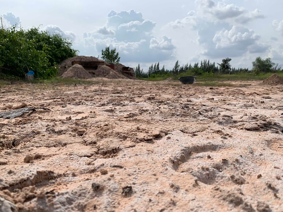
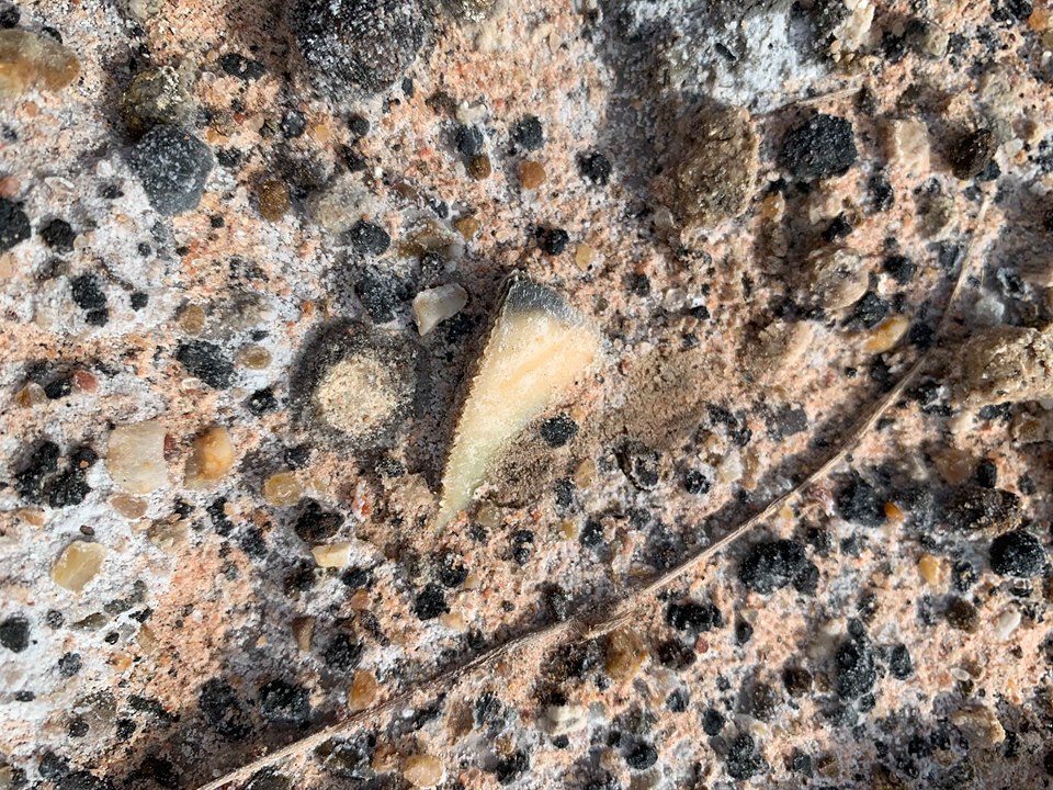
Tourist and educational areas about minerals can be found in the northern part of Mueang District and in Kham Thale So District, where a source of salt occurs, especially in Nong Suang Subdistrict. Salt is processed by withdrawing saline groundwater and releasing it into ponds and allowing the water to evaporate. As the water evaporates, the salts crystallize sequentially from calcium salts, to sodium salts, to magnesium salts, similar to the production of salt from sea water. This indicates that Northeast Thailand was once flooded by sea water, with the water eventually evaporating.
Picture 19 Source of salt occurs in Nong Suang Subdistrict, Kham Thale So District
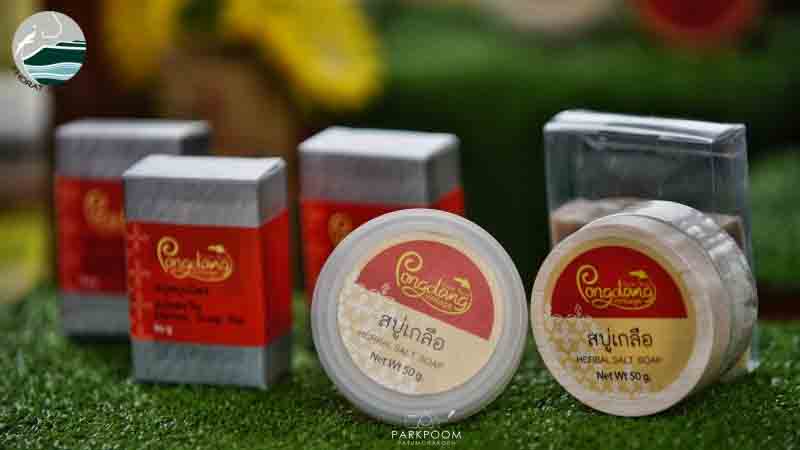
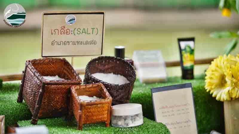
Picture 20 Product from salt
Tourist attractions related to fossils are the identity of the Khorat Geopark. This is because the region is the Paleontopolis (City of Ancient Life) of Nakhon Ratchasima and the site of the Petrified Wood Museum, the Ancient Elephant Museum, and the Dinosaur Museum since more than ten years ago at Krok Duean Ha Village, Suranaree Subdistrict, Mueang District. This subdistrict as well as the nearby subdistricts of Khok Kruat and Pong Daeng are large sources of petrified wood and dinosaurs and associated contemporaneous animals. Important fossils are mammals ranging in age from 16 million to 10 thousand years ago from Mueang District and especially from the area near the convergence of the Lam Takhong and Mun rivers at Chaloem Pra Kiat District.
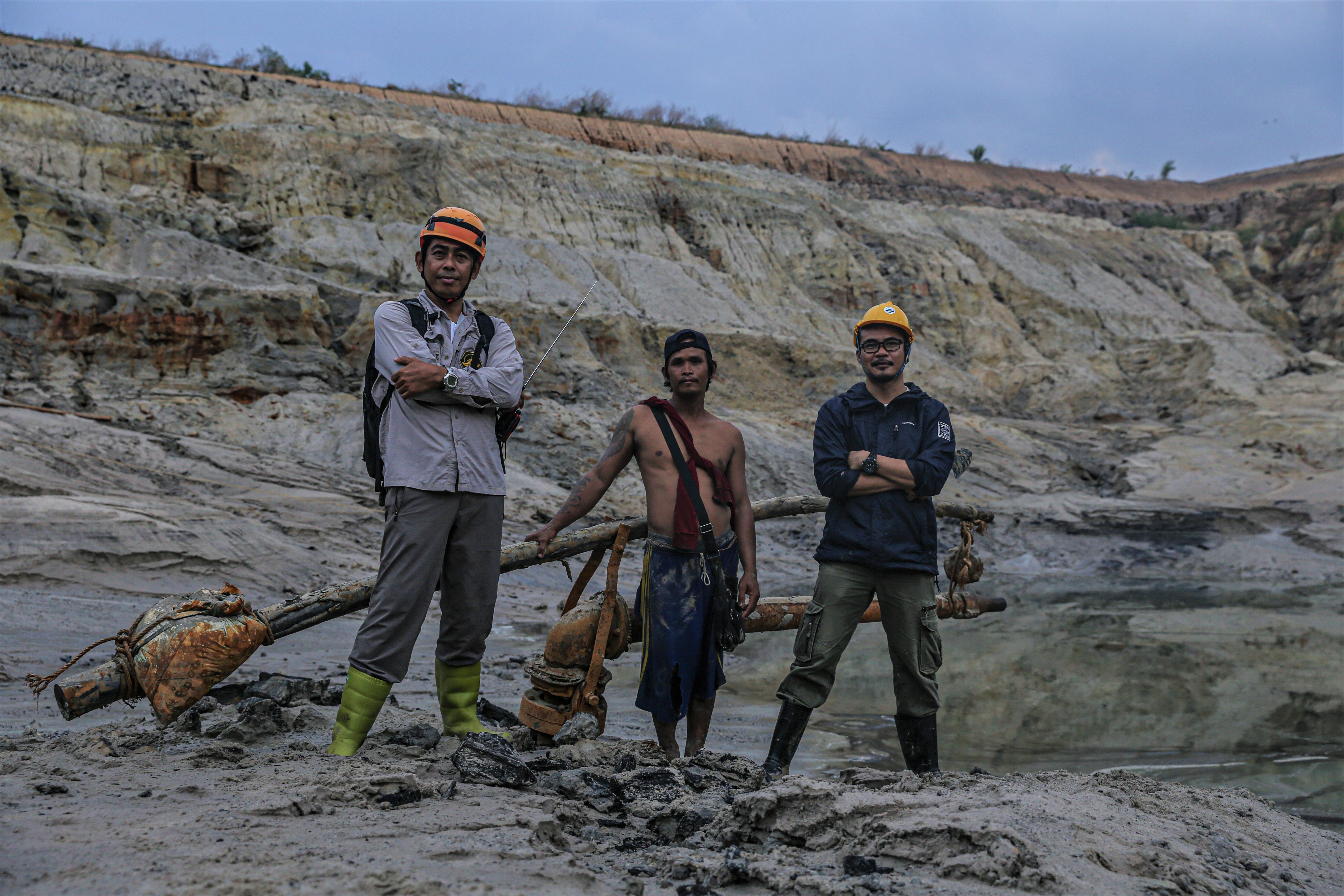
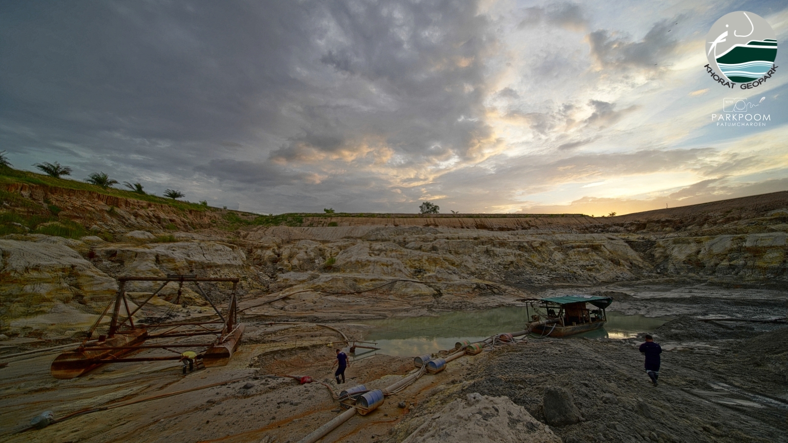
Picture 21 Chaloem Phra Kiat sand pits
Elephant fossils discovered in the area comprise 10 genera out of 55 genera of ancient elephants worldwide, or 18% of the genera. Other fossil vertebrates include rhinoceroses, hippopotamuses, short-necked giraffes, three-toed horses or Hipparion, orangutan, antelopes, calicotheres, large pigs, Merycopotomus, ancient buffaloes, saber-toothed cats, hyena, gavials, and large turtles. Consequently, conservation networks and tourism sites have been developed, including the Ancient Elephant Museum at Tha Chang Subdistrict, Chaloem Phr Kiat District, and the fossil museum at Khok Sung Subdistrict and the Khorat Dinopark at Khok Kruat Subdistrict, both in Mueang District.
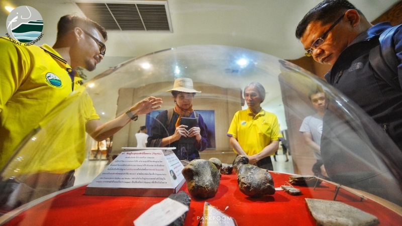
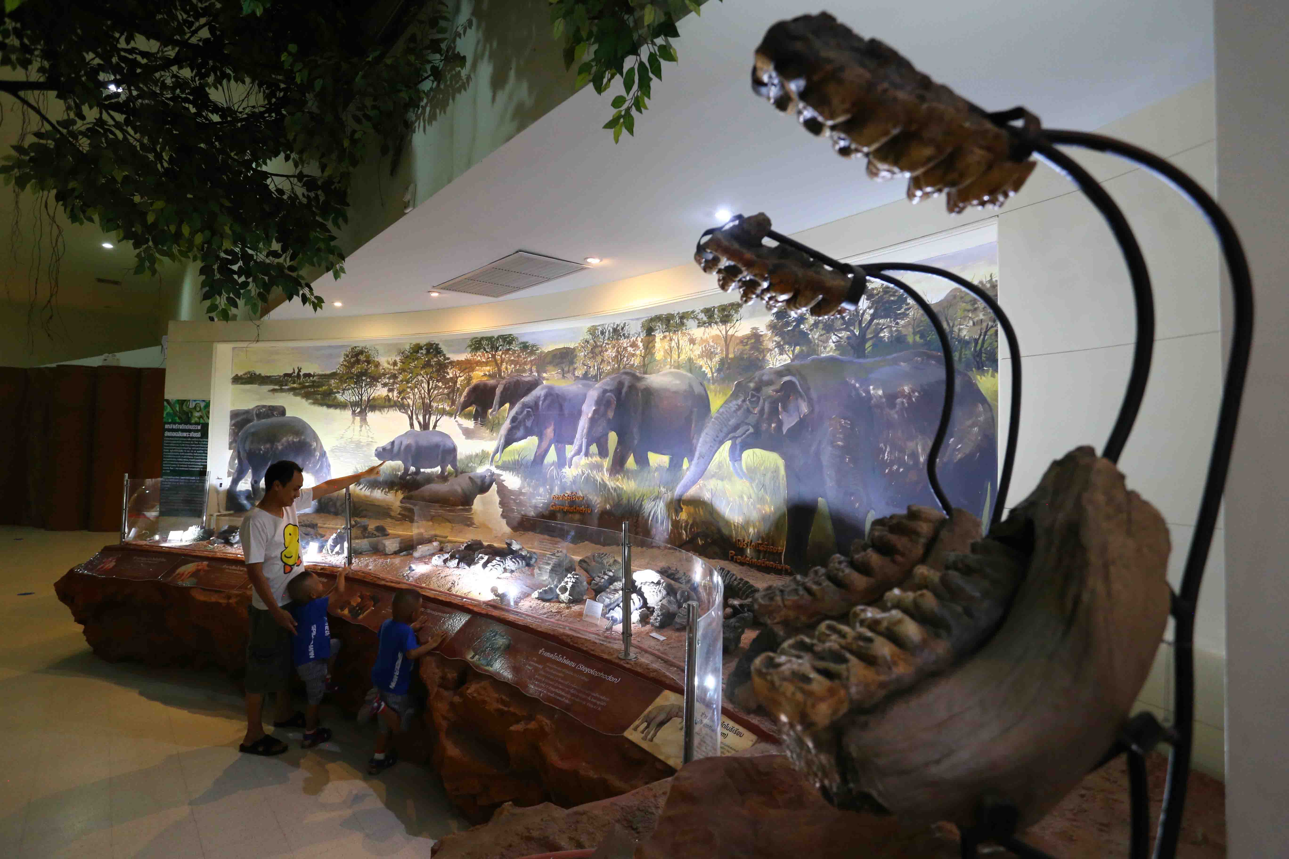
Picture 22 Various of fossils discovered in the Khorat Geopark area, were shown at Khorat Fossil Museum, Mueang District.
There are many remarkable cultural, historical, and archaeological tourist attractions related to geology in Mueang District of Nakhon Ratchasima. This is because Nakhon Ratchasima, or Khorat, is the largest city with the largest population in Northeast Thailand. Also, there is a stone sanctuary, Phanom Wan, which is a thousand years old. Additionally, the city was built according to the plans of a French engineer 360 years ago, and the surrounding moat and a segment of the city wall at the Chumphol Gate still remain. Outside this gate is a monument to Thao Suranaree, a heroine from Khorat who saved the city from an army from Vientiane in 1826. In front of the remains of the city wall, Phleng Khorat, a type of singing entertainment, is performed regularly by Khorat people using the Khorat dialect. The Khorat people make up the majority of the population in the Khorat Geopark. For those interested in the history of the settlement of the community, in different ethnic groups, and in the development of the city of Khorat, one can visit the Khorat Museum at Nakhon Ratchasima Rajabhat University.
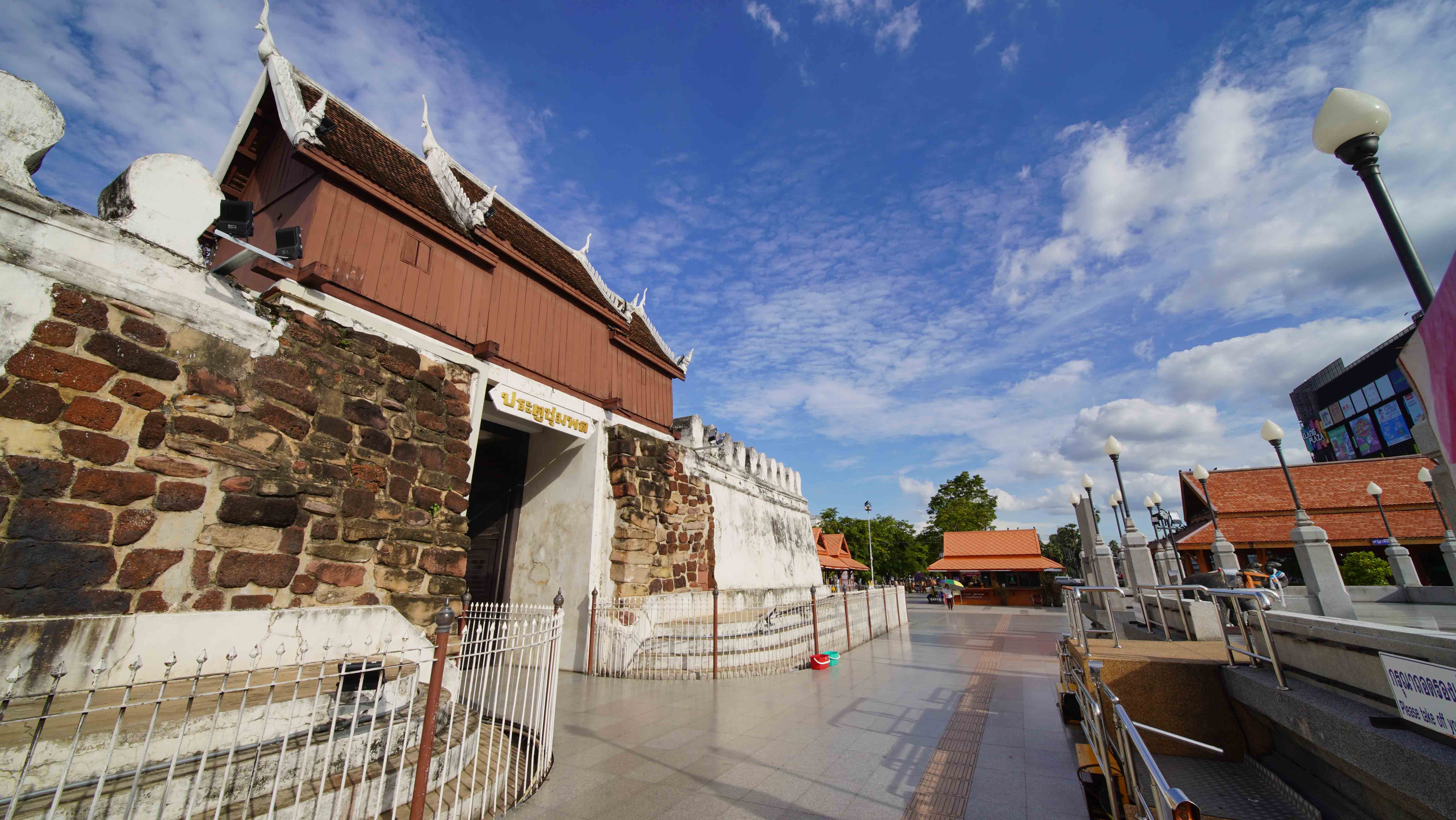
Picture 23 Phanom Wan Stone Sanctuary, Mueang District (left) Picture 24 Chumphol Gate, Mueang District (right)
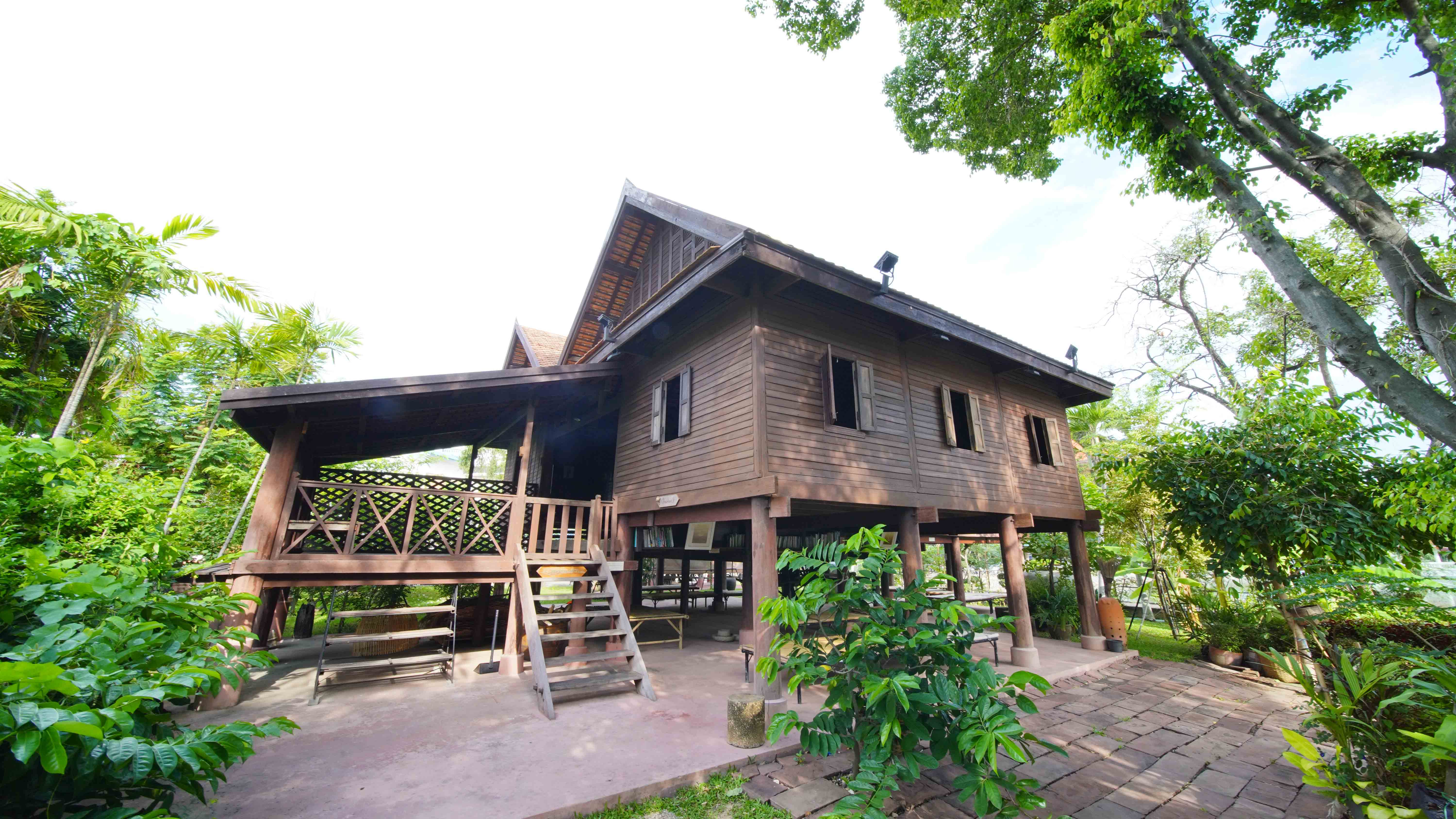
Picture 25 Khorat Museum (left) Ruean Korat (Right)at Nakhon Ratchasima Rajabhat University, Mueang District
In summary, the Khorat Geopark refers to the geographical area of the middle and lower parts of the Lam Takhon River basin. The geographic and geological features of international importance are the sandstone cuestas at and near the edge of the Khorat Plateau. Also of international importance are the numerous and highly diverse fossils, along with the present day deciduous dipterocarp forest ecosystem and the Thai Khorat culture. These areas and resources are being conserved and managed in an integrated manner by local communities for the benefit of the economy and the society, including activities related to sustainable geotourism.
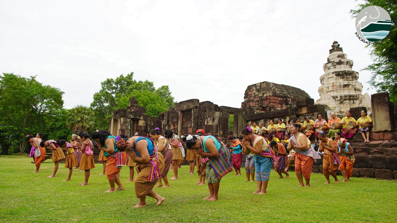
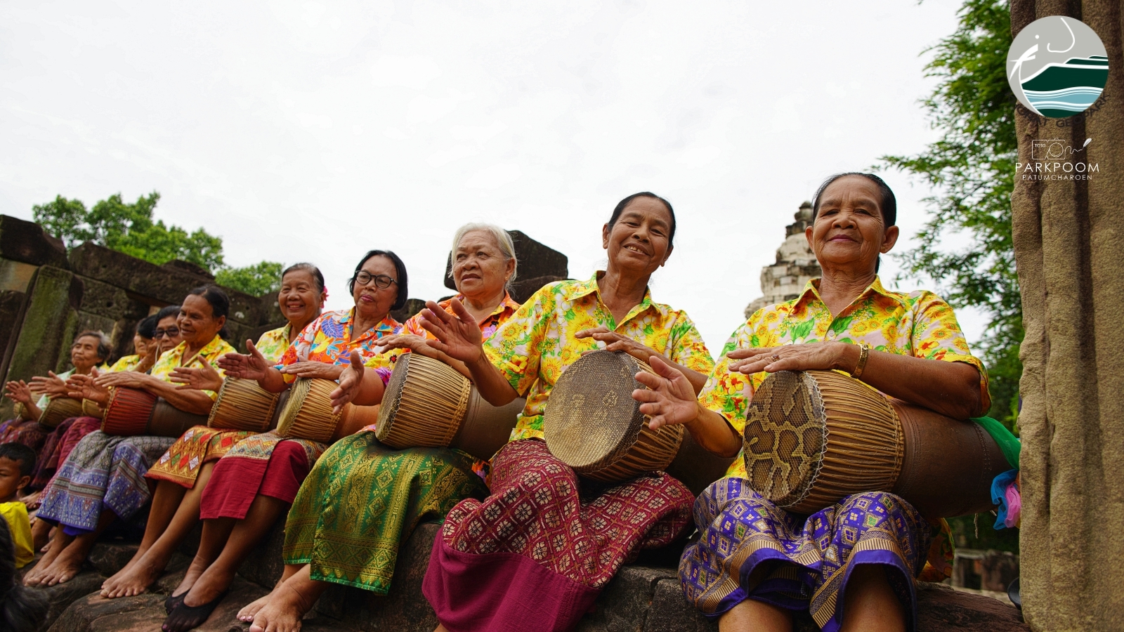
Picture 26 The traditional Thai folk dance called “Ram Tone”, a dance to the beat of “Tone”, a Thai drum at Phanom Wan Stone Sanctuary, Mueang District.
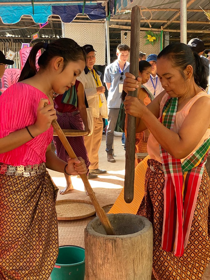
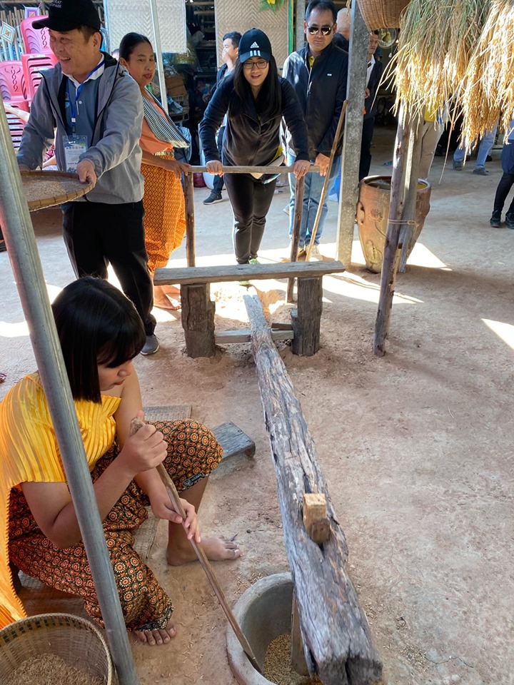
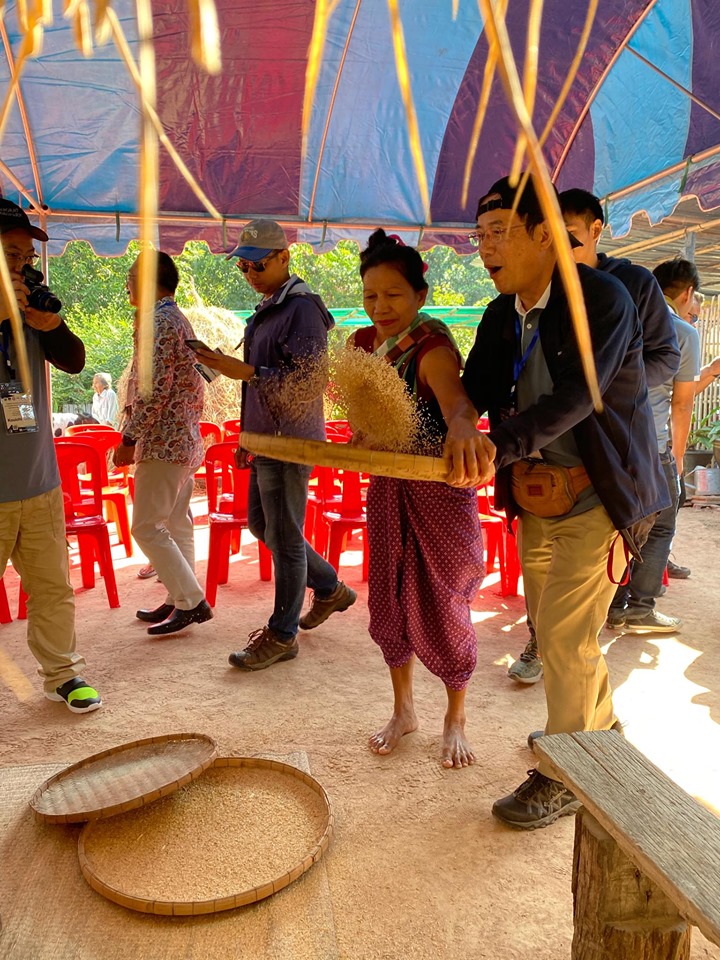
Picture 27 Local Thai mortar for pound rice and winnow rice in the past,
Ban Makha Village, Ban Pho Subdistrict, Mueang Nakhon Ratchasima District
Therefore, when we mention the uniqueness of the Khorat Geopark, we can summarize it briefly as the “Cuesta and Fossil Land” as to the identity of the geopark we can say that it is “The land of 1 mountain 1 rock 1 forest 1 river 1 culture and 3 fossils”. This refers to the cuesta mountain, the sandstone rock, the deciduous dipterocarp forest, the Lam Takhon River, the Thai Khorat culture, and the 3 fossils, petrified wood, ancient elephants, and dinosaurs and associated animals.