Main Geological Highlights & Other Elements
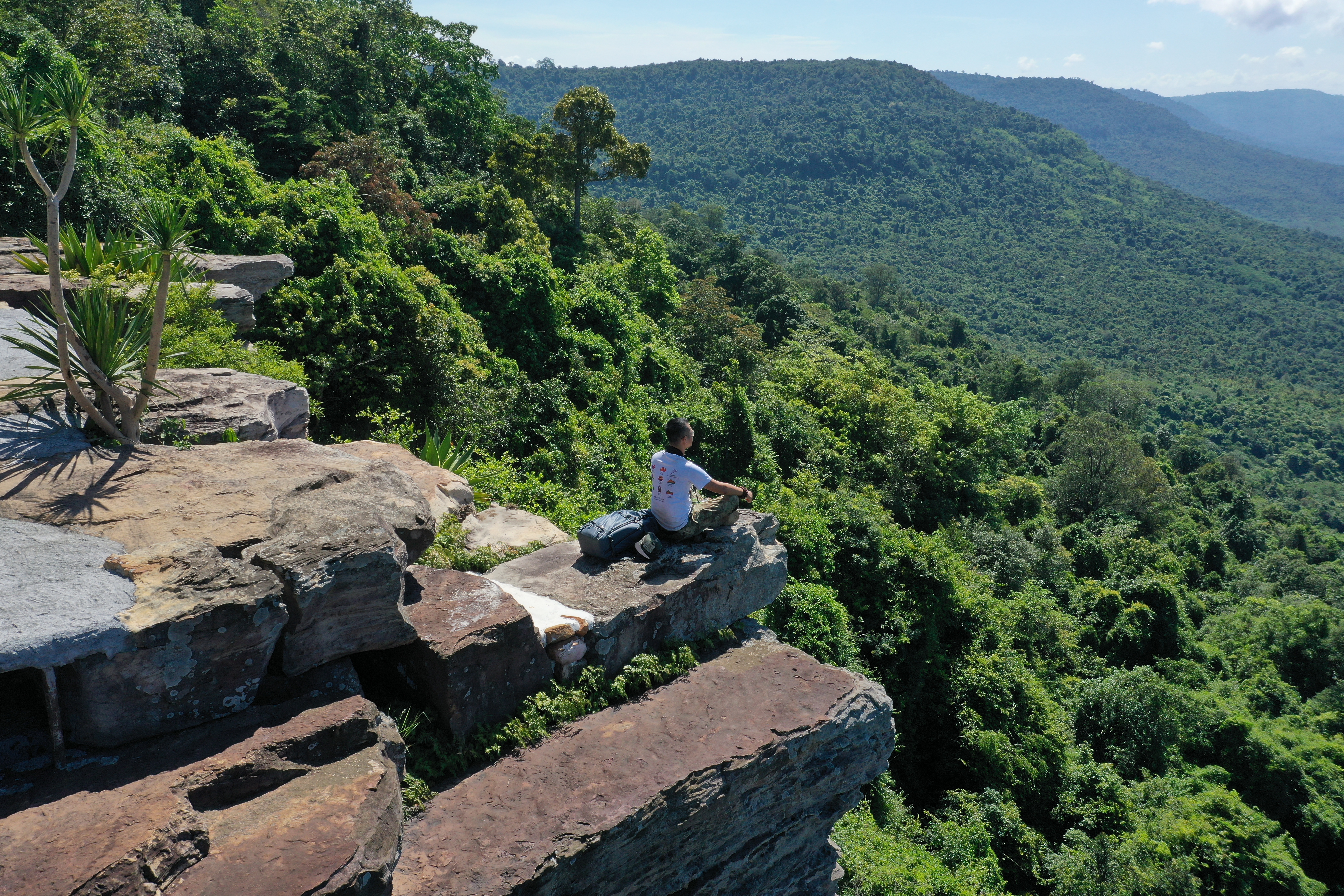
The main geological highlight in the Khorat Geopark is the great diversity of mammalian fossils from the Middle Miocene to the Pleistocene. The geopark has yielded the highest diversity per unit area worldwide of ancient elephants (10 out of 55 genera) from Chaloem Phra Kiat District, and the greatest density of mammalian fossils in South-east Asia with 15 mammalian species from a 2-hectare site in Khok Sung village. Three new species of fossil mammals have been described, an orangutan Khorapithecus piriyai, a hornless rhinoceros Aceratherium porpani, and an anthracothere Merycopotamus thachangensis. Several species of Cretaceous vertebrates are also new to science, including the iguanodont dinosaur Sirindhorna khoratensis and a new basal carcharodontosaurian theropod Siamraptor suwati. The megadiverse fossil record is Khorat Geopark’s most significant highlight. Khorat Geopark is known as “Cuesta and Fossil Land”. As visitors enter the geopark, they can see amazing views of the cuestas. Khorat Cuesta is topographically considered double cuestas with the outer range relatively continuous in the mountain-valley pattern. The cuesta also extends through the World Heritage Dong PhayaYen-Khao Yai Forest, creating a mountainous border between Thailand and Cambodia (Khao Phanom Dong Rak). In the central part of Northeast Thailand, the cuesta continues as the Phu Phan mountain range. The outer cuesta extends over 1,700 km altogether (elevations from 500-800 m asl), of which 60 km. lie within the Khorat Geopark area (the picture below). The Khorat Geopark has rich bio-, geo-, and cultural heritage. The geopark provides an informative window to the past of the Khorat landscape, along with its flora and fauna. Khao Chan Ngam Cave temple and Prehistoric Paintings have 3,000-4,000 years old pictographs from the Neolithic period.
**(please click right on each picture, and open in the new tab to get higher resolution)**
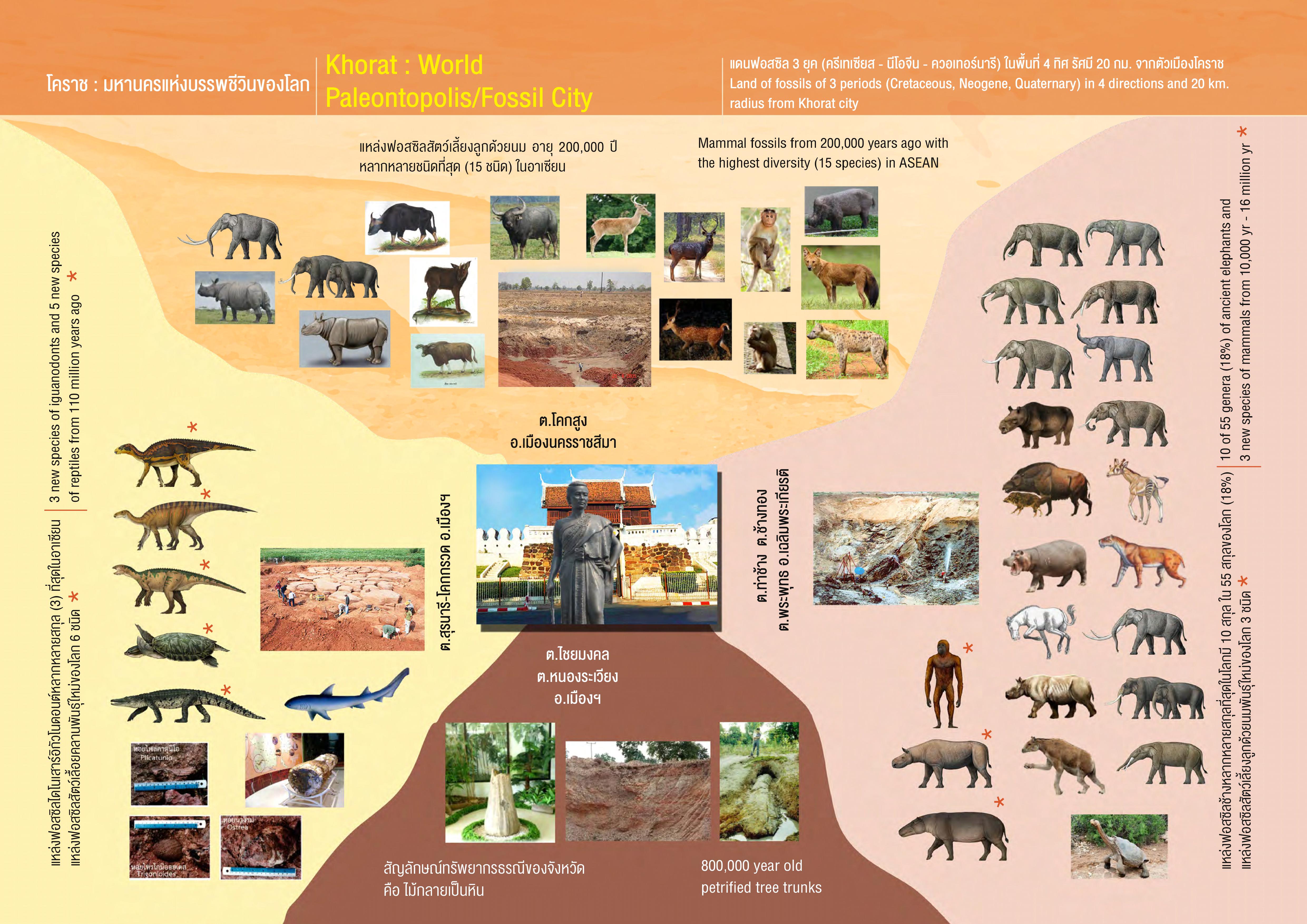
Picture 1 Khorat : World Paleontopolis/Fossil City (left)
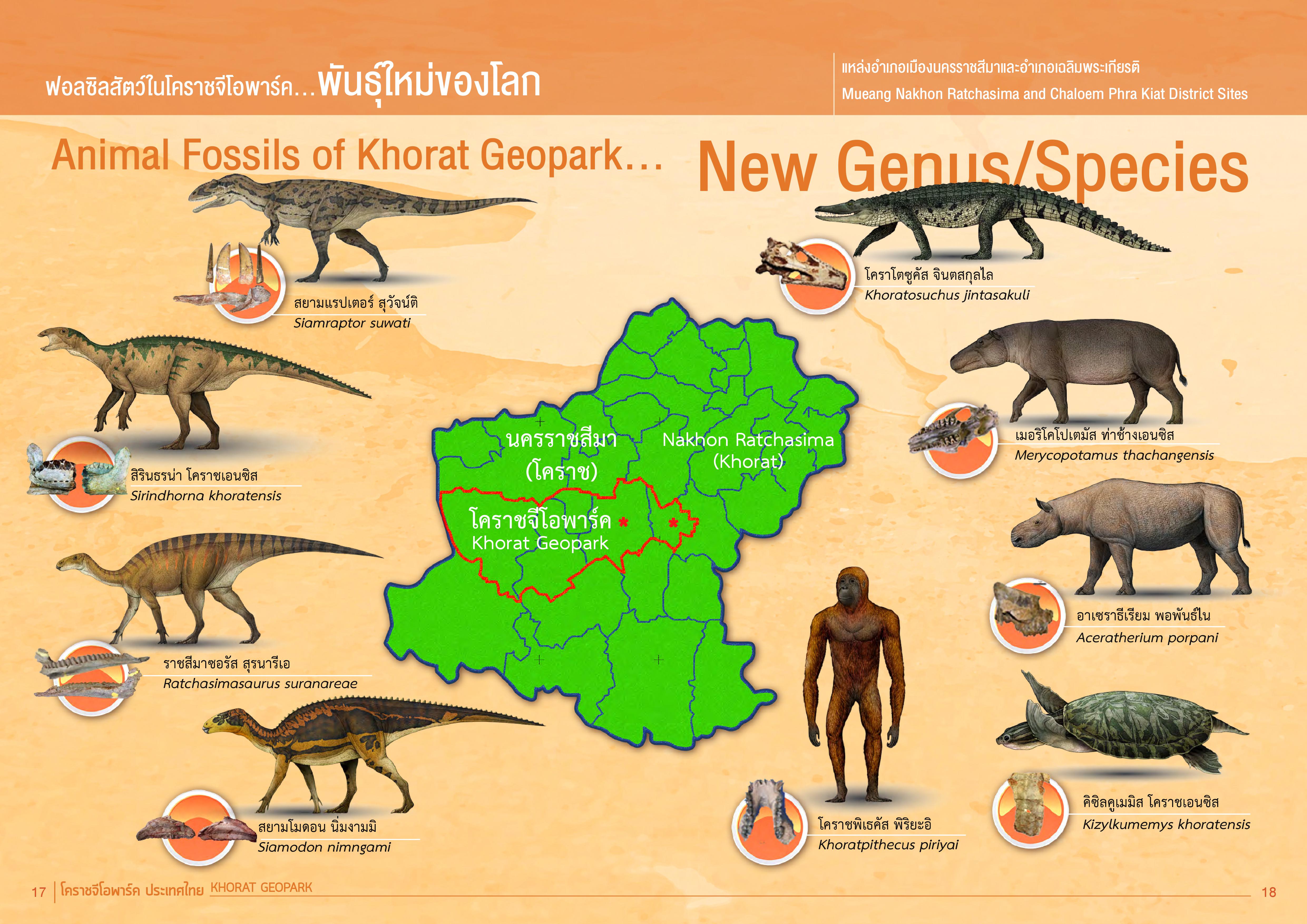
Picture 2 Animal Fossils Of Khorat Geopark (New Genus/Species) (right)
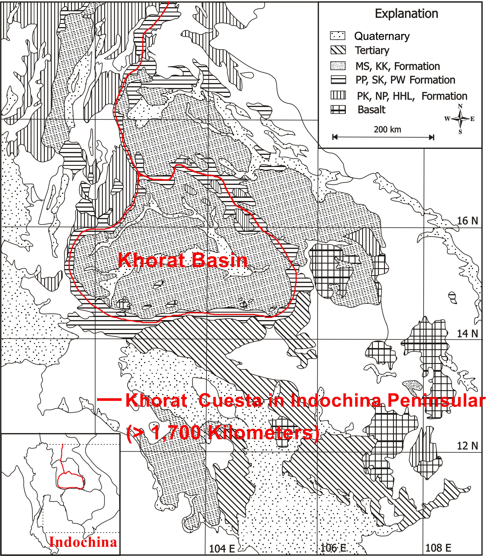

Picture 3 Khorat Cuesta in Indochina Peninsular (> 1,700 km.) (left).
Picture Credit: Engineering Agency for resources in Ventories and Tennessee Valley Authority, 1968.
Double cuesta chains, prominent in the southwest of the geopark.
The outer cuesta extends over 1,700 km altogether with 60 kilometers lying within the Khorat Geopark area (right)
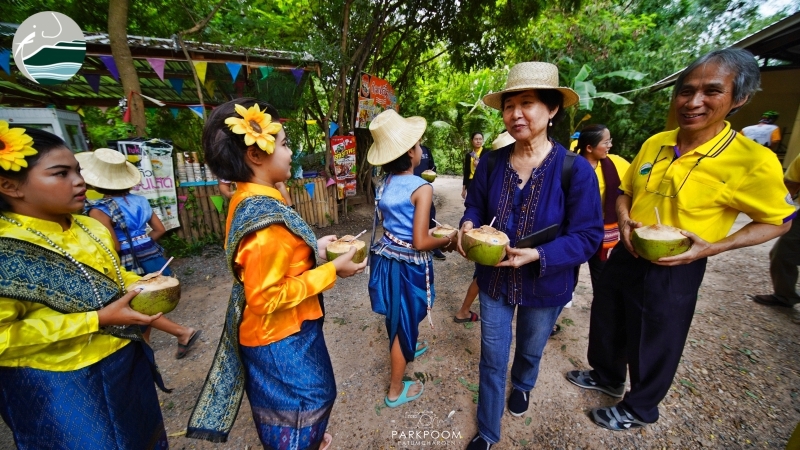
The Sikhio Sandstone Historical Quarry site has 120 million-year Phu Phan Formation white sandstone used in the construction of stone sanctuaries 800 - 1,100 years ago. The unique history, people, language, tradition, and taste of Isan food in Khorat can be found nowhere else. For example, Khorat Song is a unique folk song performed in the Khorat dialect with 7 unique dance patterns groups of 2-4 men and women in ethnic dress (Srichaichana & Potiwetchakul, 2015).
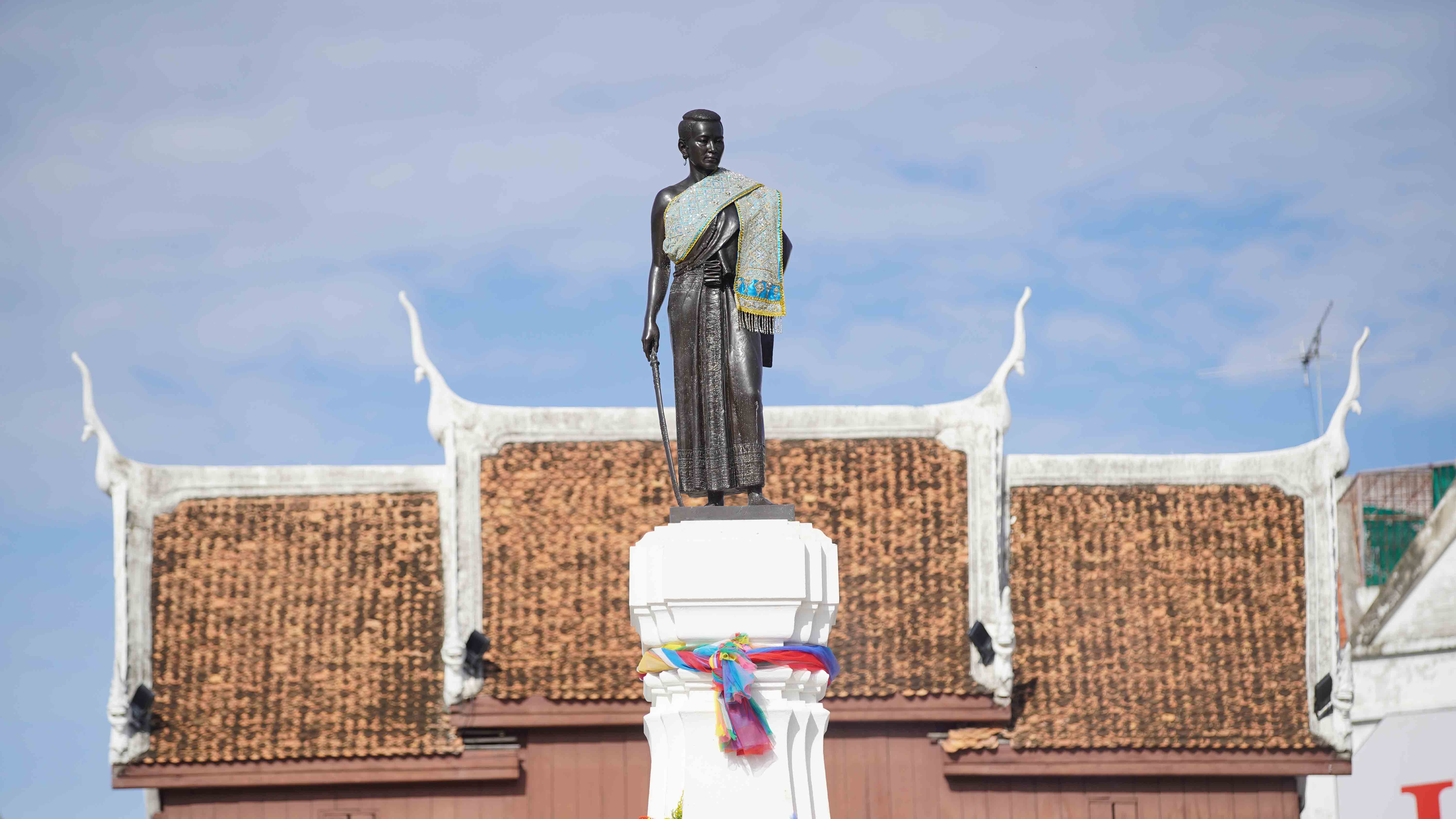
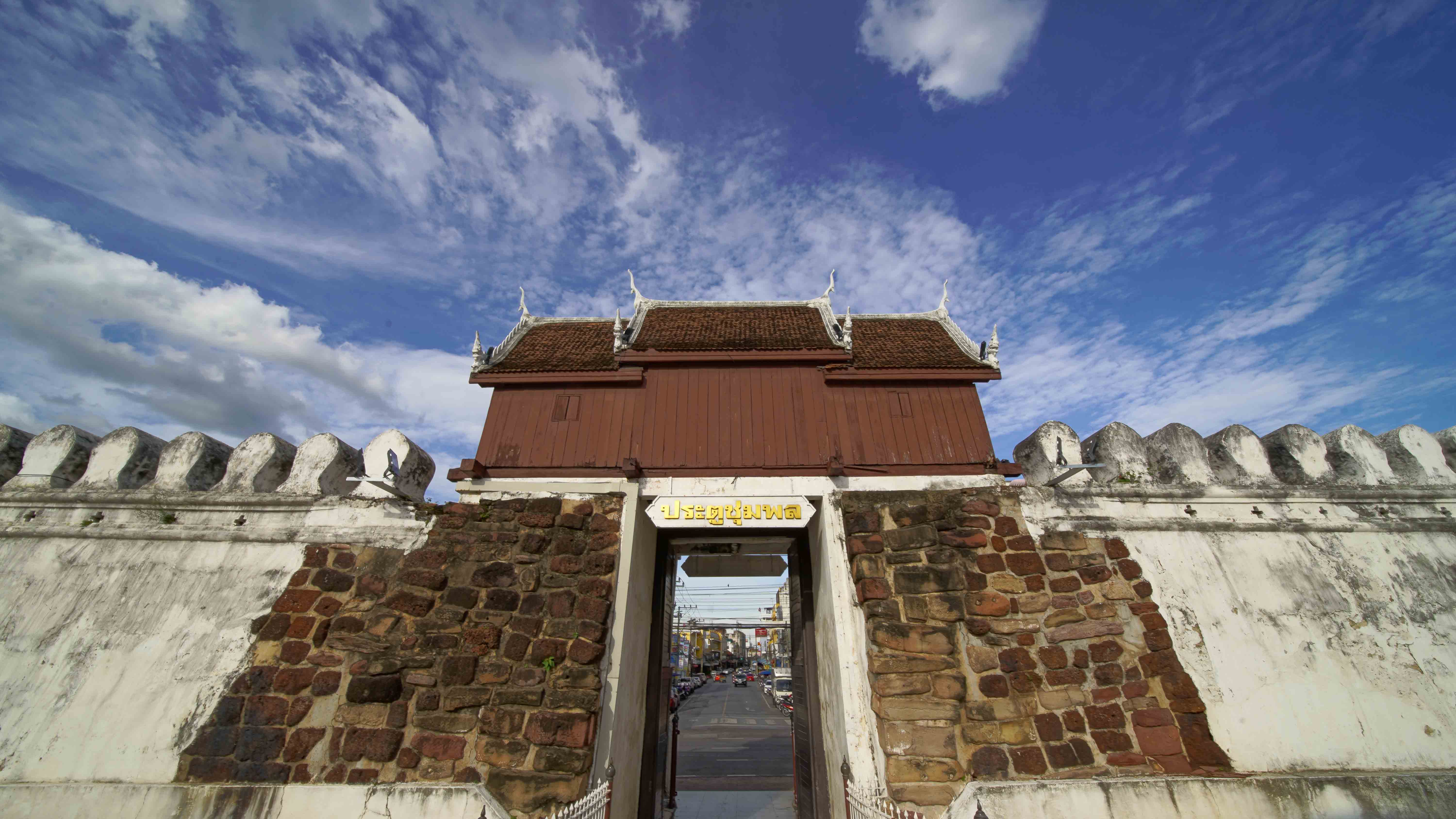
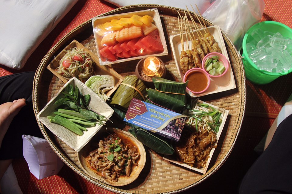
There is a unique ethnic group in the geopark: the Khorat Thai or Korat Thai, who live in Nakhon Ratchasima (approx. 4,000 of the 10,000 people live in the geopark area) with their own unique words, costumes, songs, traditions and culture that is distinct from the rest of the Thai people. Many elderly women in Khorat still wear Chong Kraben and weave textile and bamboo products. The Khorat Thai ancestors arrived in the area in the early 19th-century Schliesinger, 2001). Isan cuisine is also distinct from the rest of Thailand, with dishes like Pad mee Korat (stir-fried rice noodles in Khorat style) and other dishes on Khorat Geopark’s menu (e.g., petrified wood rolls, and Khorat cuesta rice) available at stablishments within the geopark and found nowhere else. Khorat Geopark visitors must visit the “Pratu Chumphon”, the old city gate from the reign of King Narai the Great in 1656, where legend tells that visitors who enter the gate will return to Khorat again or settle down in Khorat; and pay respect to Thao Suranaree (Lady Mo or Ya Mo) statue, a renowned heroine or Thailand’s version of Jeanne d'Arc, who protected the town when Laos invaded Siam in 1826.
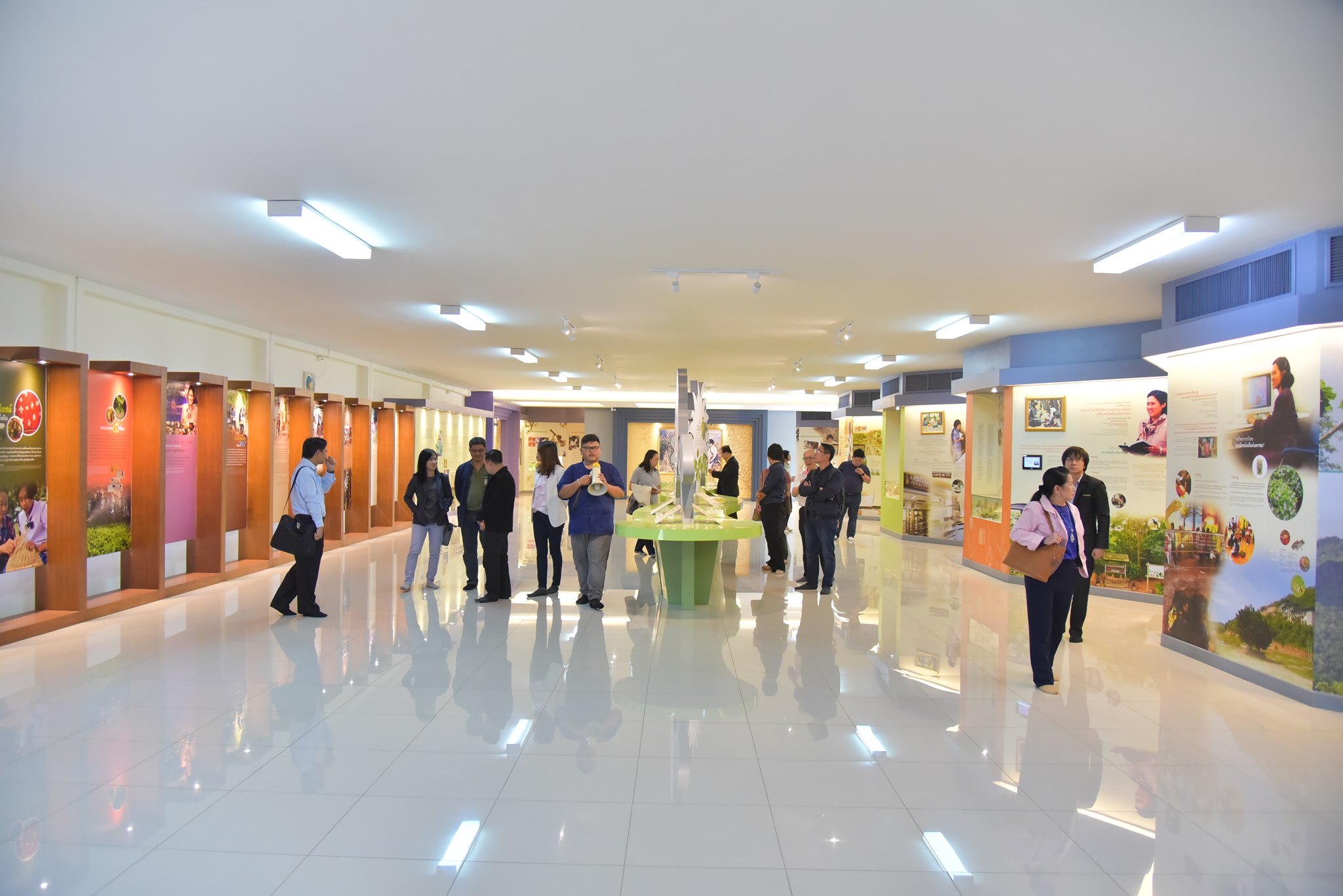
Khorat Geopark also has a variety of museums: Maha Viravong National Museum displays antiquities and artifacts from the prehistoric to the Rattanakosin Period, Moreover, visitors can learn about prehistoric life in Khorat Geopark throughout geological time and experience some interactive exhibits, e. g., 5D theater explaining the origin of the Earth, 3D model reconstructions of ancient elephants and dinosaurs, and a 3D model of a giant tree tunnel at the museum of Petrified Wood and Mineral Resources, also known as The Khorat Fossil Museum (www.khoratfossil.org/engmuseum), where the Khorat Geopark office is located. These museums are a must see and teach people about the locations within the geopark. A major draw of the geopark is its location, within a one hour drive of the Dong Phayayen-Khao Yai Forest Complex – a World Heritage site - and 40 minutes from Sakaerat – a Man and Biosphere Reserve. Therefore, visitors can plan their tours through a variety of UNESCO sites.
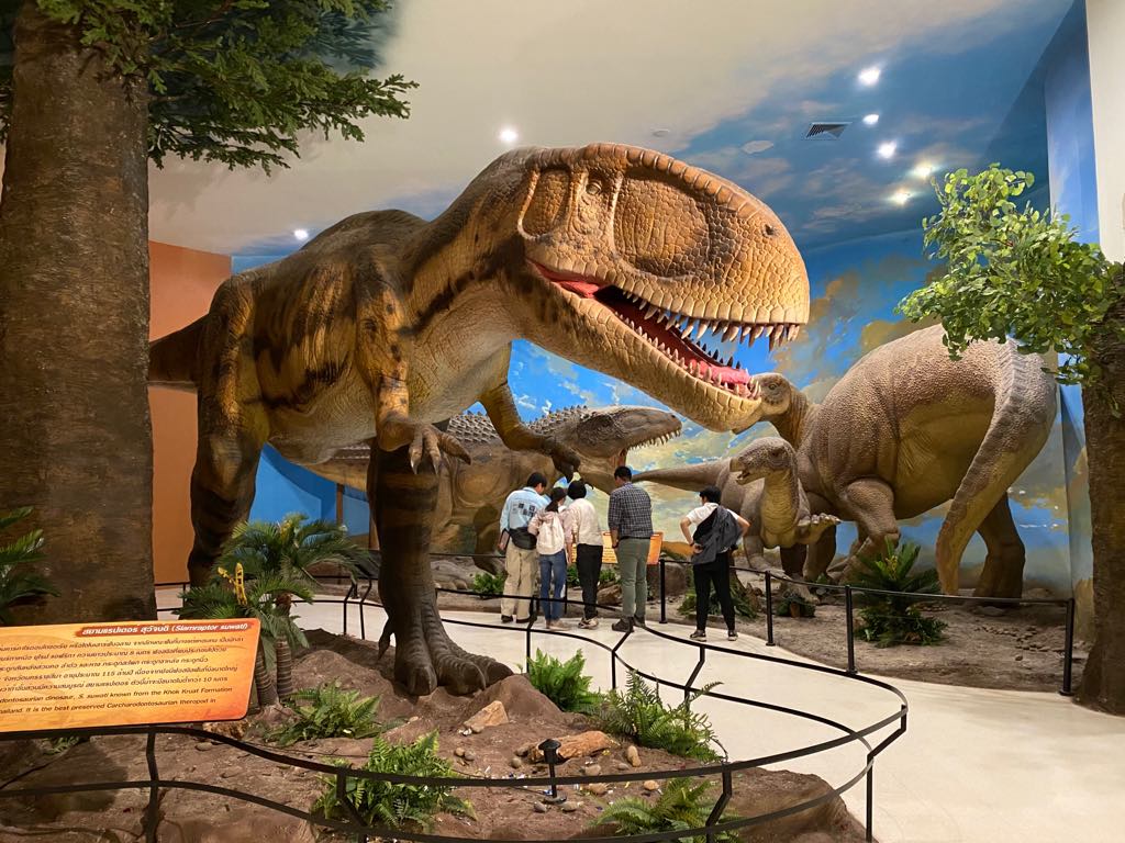
Picture 4 Khorat Fossil Museum
Territory
1. General geological description of Khorat Geopark
1.1 General geological description
Formed by a late Triassic Period collision between the Shan-Thai and Indo-China tectonic plates (approx. 237-201 million years before present), the Khorat Basin preserves an incredible array of both plant and animal fossils. Spanning back as far as 145 million years (early Cretaceous Period), the fossil beds of the Khorat Geopark provide a unique window into the geological and ecological history of the region. The tectonic movement of the prehistoric collision event elevated the Khorat Plateau and forced a lateral movement of the crust, causing the rock layers to bend and form two distinct basins in north-east Thailand. Separated by the Phu Phan mountain range, the Sakon Nakhon Basin stretches across the northern end of the region, and the Khorat Basin to the south. The Phetchabun and Dong Phaya Yen mountain ranges can be found to the west of the Khorat Basin and the San Kamphaeng and Phanom Dong Rak mountain ranges to the south. The fluvial processes of the Khorat Basin extend from the Lam Takhong, through the Mun River, and into the banks of the Mekong River on the eastern border of Thailand and Laos.
The geopark consists of seven rock units Mesozoic in age and listed in order from the oldest to youngest as follows: Phu Kradung, Phra Wihan, Sao Khua, Phu Phan and Khok Kruat formations (comprising the Khorat Group), Maha Sarakham Formation and Phu Thok Formation. Overlying are semiconsolidated and unconsolidated Neogene and Quaternary sedimentary beds. The Jurassic-Cretaceous Phu Kradung Formation is exposed along the base of the cuesta escarpment underlying the Jurassic-Cretaceous Phra Wihan Formation. Petrified wood was discovered from the Phu Kradung Formation. Iguanodonts, pterosaurs, freshwater sharks, turtles, and crocodiles were discovered from the Khok Kruat Formation. The Maha Sarakham Formation is a salt-bearing rock unit as the source of sodium and potassium salt production as well as the source of groundwater contamination.
Picture 5 Geological map of Khorat Geopark shows geological sites
.jpg)
Picture 6 Stratigraphic Column of Khorat Geopark
Picture 7 Geological formations and sediments found in Khorat Geopark.
1.2 Listing and description of geological sites within Khorat Geopark (see the table below)
Khorat Geopark has 21 geological sites divided into 3 categories, i.e., Scientific: Useful for scientific research, restricted entrance for protection or restricted private property, entry permitted only to researchers; Education: Entrance permitted to groups for education and scientific research; Tourism: Open widely for tourists, for relaxation, admiration of beauty, and experiencing novelty.
Picture 8 Map of Geosites in Khorat Geopark
1.3 Details on the interest of these sites in terms of their international, regional, national, or local value.
The level of importance and interest in 21 geological sites is also mentioned in Table below Four selected geological sites of international value are mentioned in details as follows: Geological Site No 4: The Krok Duean Ha Petrified Forest and Museum is in Suranaree Sub-district. Mueang Nakhon Ratchasima District. The earliest systematic description on Thai geology (Contributions to the Geology and Morphology of Siam) included a report on the fossil wood of Khorat Geopark and was published
Table of List and descriptions of geological sites in the Khorat Geopark.
.jpg)
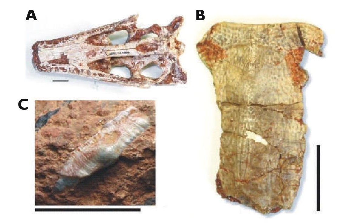
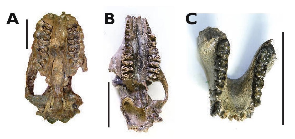
Picture 9 New dinosaurs in Khorat Geopark. A) Siamodon nimgnami, B) Ratchasimasaurus suranareae,
C) Sirindhorna khoratensis, and D) Siamraptor suwati (Buffetaut and Suteethorn, 2011; Shibata et al., 2011;
Shibata et al., 2015; Chockchaloemwong et al., 2019). Scale bars for A, B and C are 5 cm; scale bar for D is 10 cm.
Picture 10 Other Cretaceous vertebrate fossils from Khorat Geopark A) crocodile (Khoratosuchus jintasakuli)
B) turtle (Kizylkumemys khoratensis) C) shark (Thaiodus ruchae)
(Cappetta et al., 1990; Tong et al., 2005; Lauprasert et al., 2009). Scale bars are 2 cm.
by a Swedish geologist, Bertil Högbom, in 1913 (Department of Science, 1952; Högbom 1913).
Thailand’s first fossil wood conservation record in the geopark dates back to 1921 when King Rama VI visited a railway construction site crossing the Mun River in Chaloem Phrakiat District and local people presented him a piece of petrified wood. The uniqueness of the gift resulted in the King’s suggestion to conserve the fossil in the area. Shortly after, the community constructed a petrified wood monument next to the Saphan Dam (referred to as the Black Bridge on the Mun River railway crossing) to memorialize the event (Fig. D.6). About 50 species of petrified wood have been found throughout the Khorat Geopark, mostly in Pleistocene alluvial deposits, such as Mangiferoxylon, Canarium, Terminalia, Irvingia, Millettia, and Careya. The petrified wood includes three new species discovered and published from the Khorat Geopark-two fossils from the family Dipterocarpaceae (Dipterocarpoxylon sarapeense and Shoreoxylon thailandense) (Vozenin-Serra and Privé-Gill, 1989; Vozenin-Serra and Privé-Gill, 2001) and the third from the family Combretaceae, Terminalioxylon paracoriaceum (Vozenin-Serra and Privé-Gill, 2001), all Pliocene or Pleistocene in age.
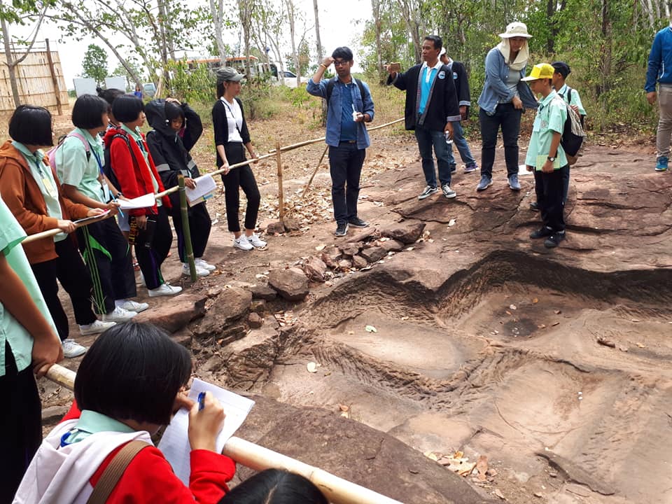
Geological Site No 5: Khok Kruat Dinosaur site, Mueang Nakhon Ratchasima District, contains the highest abundance of iguanodont dinosaur fossils in south-east Asia (Picture 9). Other vertebrates from the Cretaceous Period (Picture 10) include pterosaurs, freshwater sharks, turtles, and crocodiles (Cappetta et al., 1990), with mollusks being found as well (Cappetta et al., 1990). Six new species from these sites have had their discoveries published: three iguanodonts, Siamodon nimgnami, Ratchasimasaurus suranareae, and Sirindhorna khoratensis (Buffetaut and Suteethorn, 2011; Shibata et al., 2011.; Shibata et al., 2015), a carcharodontosaurian theropod dinosaur, Siamraptor suwati (Chokchaloemwong et al., 2019), a turtle Kizylkumemys khoratensis (Tong et al., 2005), and a crocodile Khoratosuchus jintasakuli (Lauprasert et al., 2009; Kubo et al., 2018). The Khok Kruat Formation (early Cretaceous Period, ca. 110 million years ago) is the uppermost rock formation of the Khorat Group (Capetta et al., 1990), and takes its name from the type section at Khok Kruat Village located in the Khok Kruat Subdistrict of Mueang Nakhon Ratchasima District in the geopark. The sediments within the Khok Kruat Formation are characterized by reddish sandstone, which is commonly fine-grained or cobbled; mudstone and quartz gravel is also present in some sediment layers. The upper layers of the formation contain gypsum and a thin layer of sandstone. In some areas, the sediment cycle between channel conglomerates, channel sandstones, overbank siltstones and flood-plain siltstones and mudstones with variable thickness, while other areas contain no channel conglomerates.
Picture 11 Mammalian fossils from the sediments of Mueang Nakhon Ratchasima District A) Stegodon (Stegodon cf.
orientalis) (B) Hyena (Crocuta crocuta) and (C) chital (Axis axis) (Suraprasit et al., 2016). All scale bars are 5 cm.
Geological Site No 3: The Khok Sung fossil site consists of a 7 meter thick alluvial plain deposit encompassing the ancient Mun River fluviatile sediments from the late middle Pleistocene Period (ca. 0.217 Ma or 0.13 Ma, Duval et al., 2019). At least 15 mammalian species, including proboscideans, hyena, rhinoceroses, bovids (e.g., kouprey, buffalo, Sumatran serow, Eld's deer, spotted deer) bearded pig, canid, and macaque are present in the deposits (Picture 11). Similar to the sandpits of the region, other vertebrate fossils have also been found; among them are tortoises, softshell turtles, crocodiles, gharials, a lizard, reticulated python, junglefowl, and bony fish. An abundance of plant fossils, including wood, leaves, fruits, seeds, and pollen, have also been found, including a new species of jujube, Ziziphus khoksungensis (Grote, 2007). The large mammal assemblages found in this fossil site provide evidence for the hypothesis that Thailand was a central biogeographic hub or pathway for the Sino-Malayan migration event from south China to Java (Suraprasit et al., 2016).
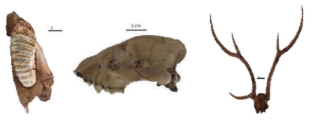
Picture 12 New ancient mammal species discoveries from Khorat Geopark A) Aceratherium porpani (Deng et al.,
2013) B) Merycopotamus thachangensis C) Khoratpithecus piriyai. All scale bars are 10 cm.
Geological Site No 1: Chaloem Phra Kiat sandpits in Chaloem Phra Kiat District consists of a 58 meter thick ancient Mun River alluvial deposit (approximately 16-0.01 million years before present or middle Miocene to late Pleistocene age) and has yielded world-renowned fossil mammal sites, including proboscidean (ancient elephants). Ten out of the 55 known proboscidean genera worldwide (18%) are from the Khorat Geopark’s Mun River alluvial deposits; i.e., Deinotherium, Elephas, Gomphotherium, Prodeinotherium, Protanancus, Sinomastodon, Stegodon, Stegolophodon, Tetralophodon, and Zygolophodon (Saegusa et al., 2005; Thasod and Ratanasthien, 2005; Thasod et al., 2012; Duangkrayom et al., 2016). At least three new ancient mammal species (Picture 12): an orangutanlike ape, Khoratpithecus piriyai (Chaimanee et al., 2004), an anthracothere, Merycopotamus thachangensis (Hanta et al., 2008) and a hornless rhinoceros, Aceratherium porpani (Deng et al., 2013), have been published. In addition, giant tortoises (Megalochelys sp.) have been found (Claude et al., 2011; Naksri et al., 2019).
1.4 Current or potential pressure on the geological sites regarding their preservation and proper maintenance
In the 1990s, there was a crisis with the mass selling of petrified trunks in Nakhon Ratchasima Province. When this issue made the national headlines, a natural resource seminar was held by a local university (Nakhon Ratchasima Rajabhat University) to raise awareness of the problem, which resulted in the proposal for the establishment of the Petrified Wood Museum in 1994. Since then local people have been reporting the discoveries of other fossils to the museum, The expansion of the museum to be the Northeastern Research Institute of Petrified Wood & Mineral Resources (In Honour of His Majesty the King) and the Khorat Geopark has led to the achievement of more sustainable conservation. After the establishment of the museum and the geopark, theft of petrified wood and other fossils has significantly decreased. Currently, there is still occasional theft of geological assets at some of the geosites, such as pieces of the Khok Kruat rock at the excavation sites in Suranaree and Khok Kruat sub-districts and fossils located at the Tha Chang sandpits, Chaloem Phra Kiat District. However, these lands are privately owned and the assets are protected under the law of Fossil Protection Act B.E. 2551 (2008).
1.5 Current status in terms of protection of geological sites within the aUGGp
The geological sites in the geopark are protected by Thai national law i.e. Minerals Act, B.E. 2560 (2017). Although some sites are in private land, the fossils found in these sites are protected by the “Fossil Protection Act B.E. 2551 (2008)” and can be moved to the museum. The geopark administrative committee and scientists have contact with the private land owners and local residents to collaborate on the protection and sustainable development by using the sites for geoeducation and geotourism. So far the response has been positive, with good collaboration for most of the sites. Visitors can still access the sites by contacting the Khorat Geopark Office for geoeducation and geotourism purposes. The sites related to archaeology are protected by the Archaeological Sites, Artifacts, Artistic Objects and National Museum Act B.E. 2504 (1961) amendment No. 2 in B.E. 2535 (1992); the geological sites situated in the natural conserved forests are legally protected under the national laws. National Reserved Forest Act, B.E. 2507 (1964), National Reserved Forest Act (NO.4), B.E. 2559 (2016), Groundwater Act, B.C. 2520 (1977), Water Resource Act, B.E. 2561 (2018), Agricultural Land Reform Act B.E. 2518 (1975), Community Forest Act B.E. 2562 (2019), and Enhancement and Conservation of National Environment Quality Act, B.E. 2535 (1992).
Other Heritage
Khorat Geopark is not only rich in natural heritage, but also diverse and unique in languages, food, and cultures from six ethnic groups. The geopark has a long cultural history related to its geological heritage such as the Neolithic tools made of fossil wood, pictographs on sandstone, the 10th-century A.D. stone sanctuaries (also known as Prasat Hin) from the Khmer Empire, the ancient city wall from the middle decades of the 17th century and other interesting intangible heritage. There are no other UNESCO Programmes overlapping in the geopark area.
1. Natural heritage
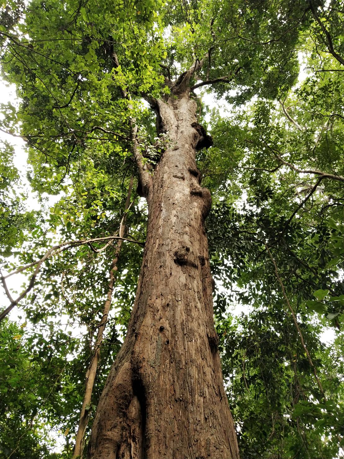
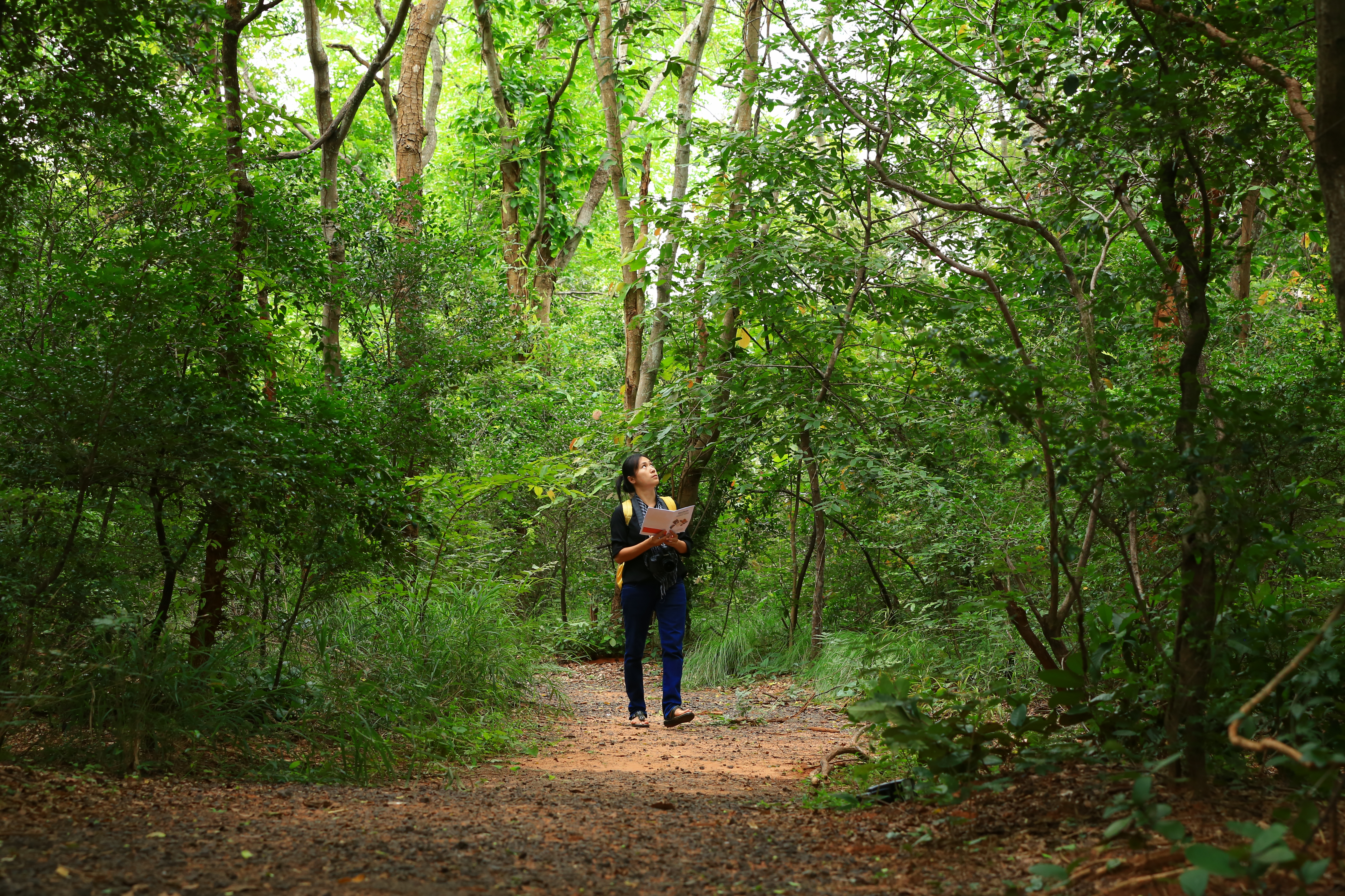
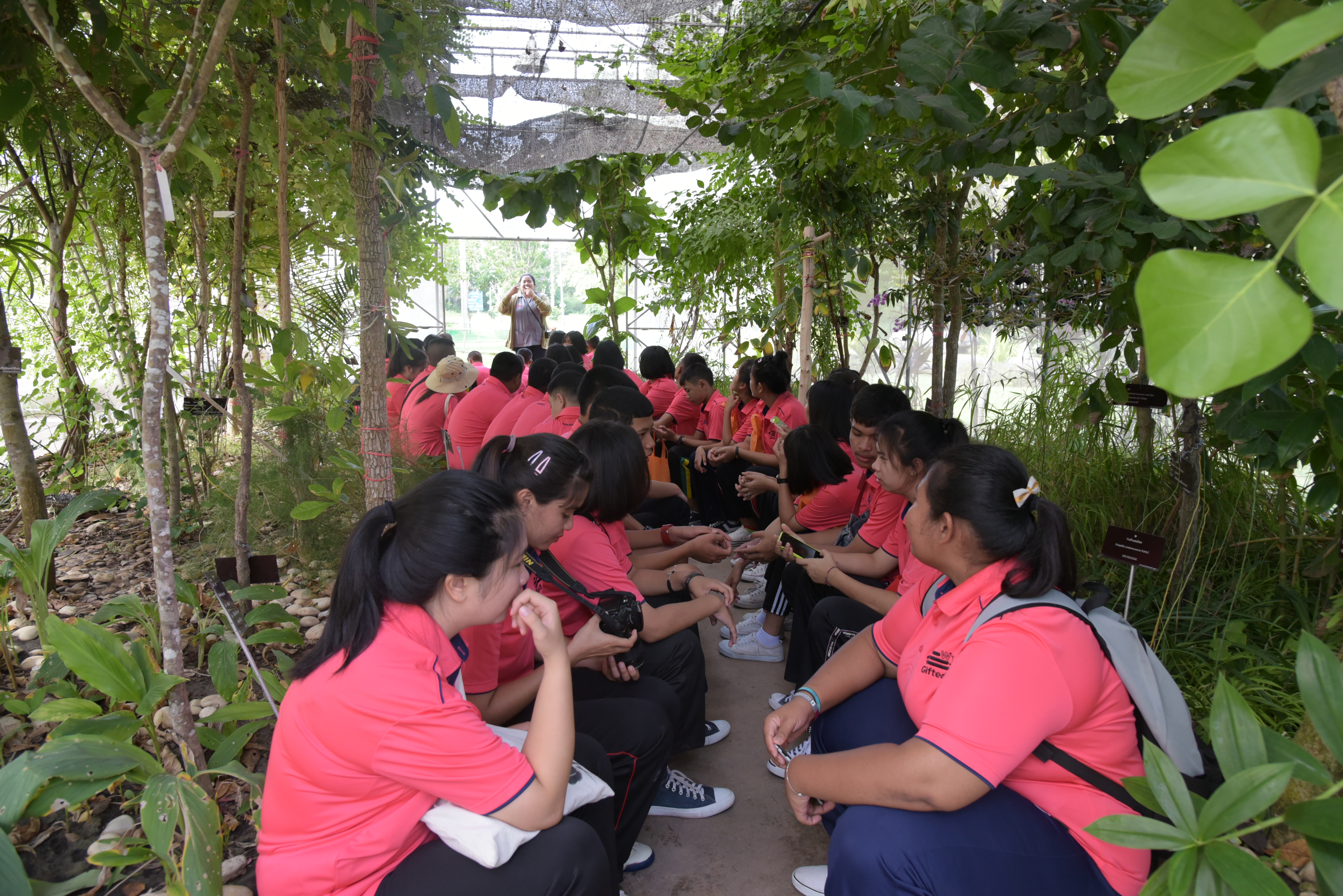
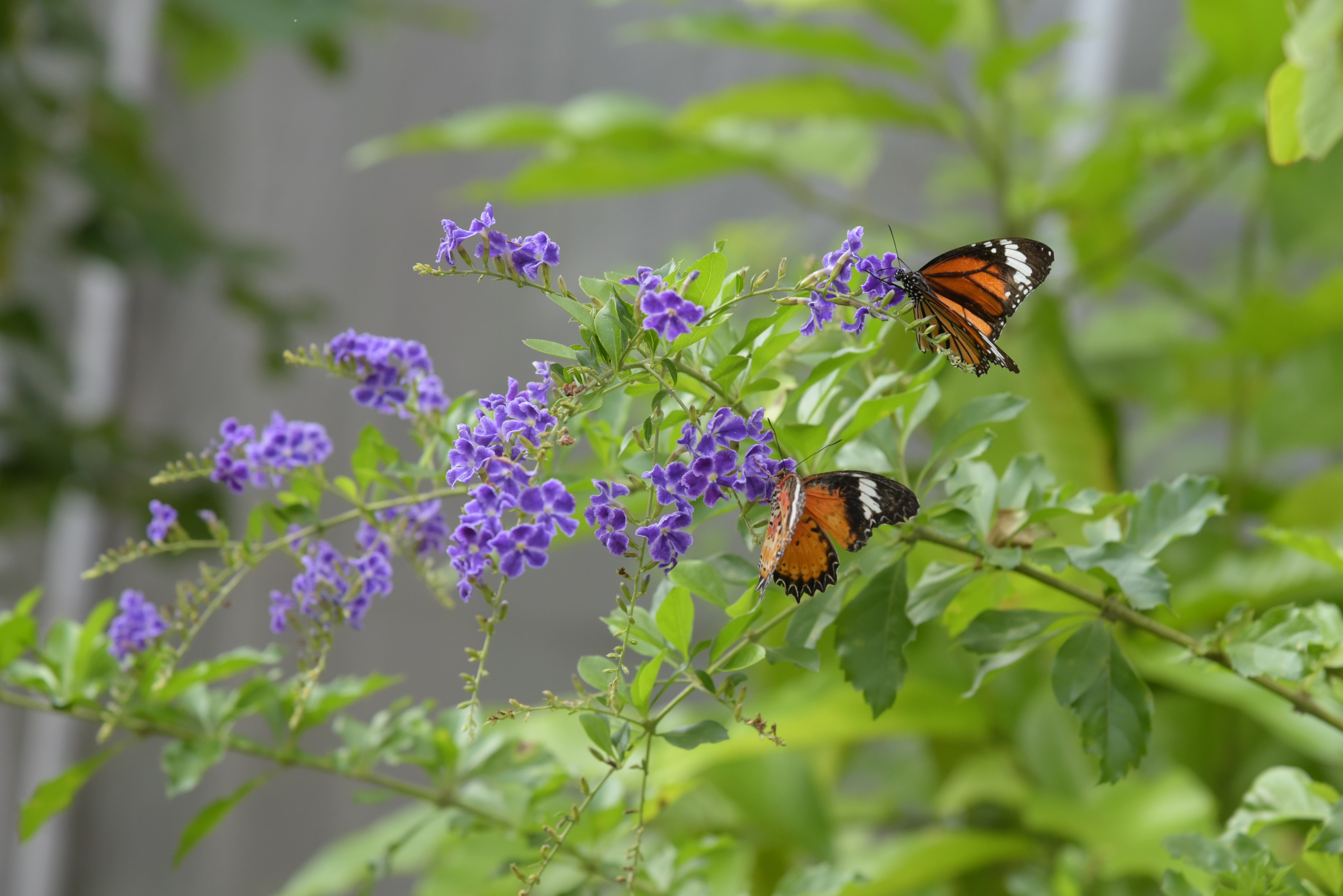
Throughout the lower elevations of the Khorat Geopark, amongst cities, villages, and agricultural areas, are patches of forest, mostly dry dipterocarp forest dominated by dipterocarp (winged fruit) trees, especially Shorea siamensis, Shorea obtusa, Dipterocarpus tuberculatus, and Dipterocarpus obtusifolius. Bamboo, especially Vietnamosasa pusilla, and other grasses are common in the undergrowth. Numerous birds, reptiles, and smaller mammals are still common. At the higher altitudes of the outer range of cuestas (reaching to > 700 m above sea level), dry evergreen forests are common, with dominant species including the dipterocarps Hopea ferrea and Shorea henryana. Figs trees are well represented, such as Ficus benjamina and Ficus pubilimba. Birds, reptiles, and mammals are also common in these forests, especially white squirrels Calosciurus finlaysonii. The Khorat supple skink, Lysosoma koratense, was first reported from Sikhio District and is endemic to Thailand. The geopark has 4 main natural heritage sites. None of them are recognized under other UNESCO programs.


Picture 13 Lygosoma koratense is a new species of Khorat Geopark which is the first found in Sikhio District in 1917. (left)
Picture 14 Cardamom Forest Gecko, Cyrtodactylus intermedius (right)

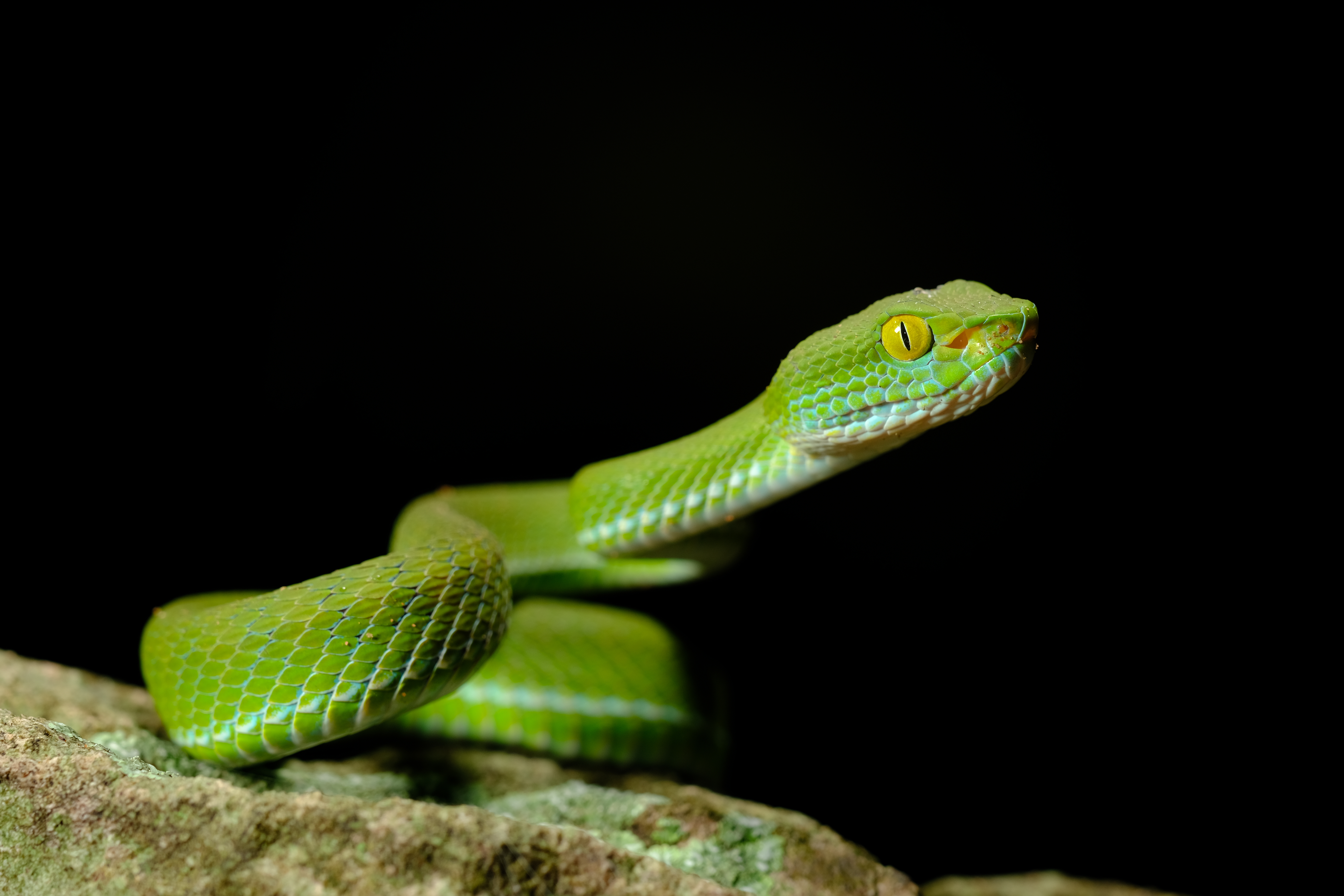
Picture 15 Lesser giant flying squirrel Petaurista elegans (left) Trimeresurus sp. (right)
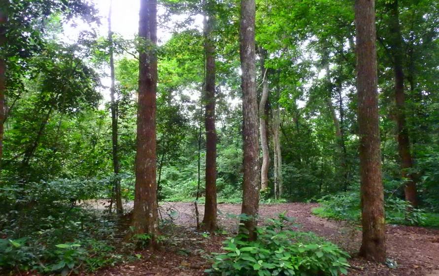
Picture 16 Dry Dipterocarp Forest
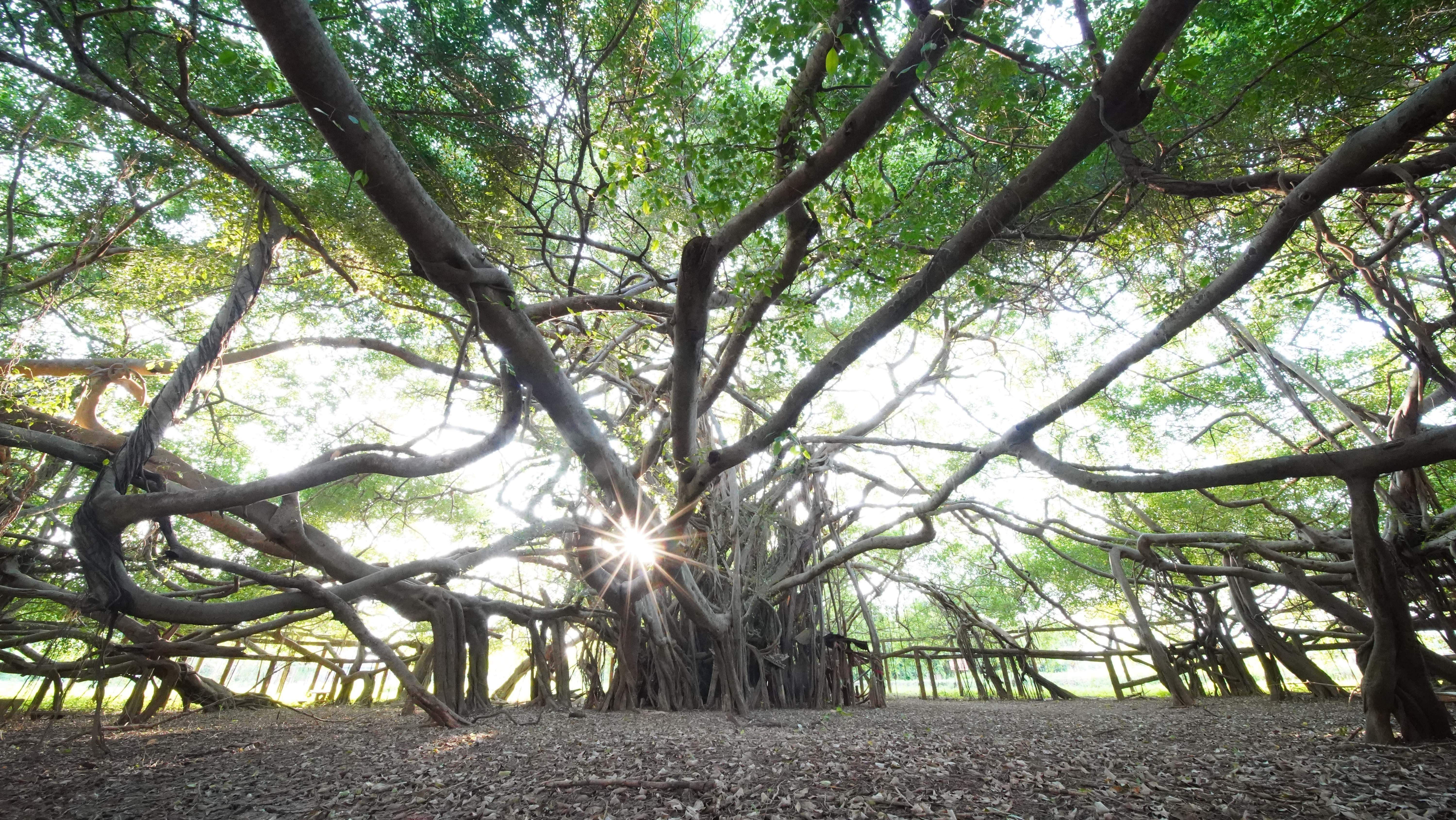
Chaloem Phra Kiat Banyan Tree
Importance: Tourism
Level: LOC
This large banyan tree of the species Ficus benjamina, is estimated to be approximately 200 years old. This single sprawling tree covers an area of approximately 0.32 hectares near the bank of the Mun River in Chaloem Phra Kiat District It provides a shady, cool atmosphere, natural beauty and is an important part of the ecosystem.
Nong Rawiang Plant Genetic Conservation Center
Importance: Scientific, Educational, Tourism and Protected
Level: REG
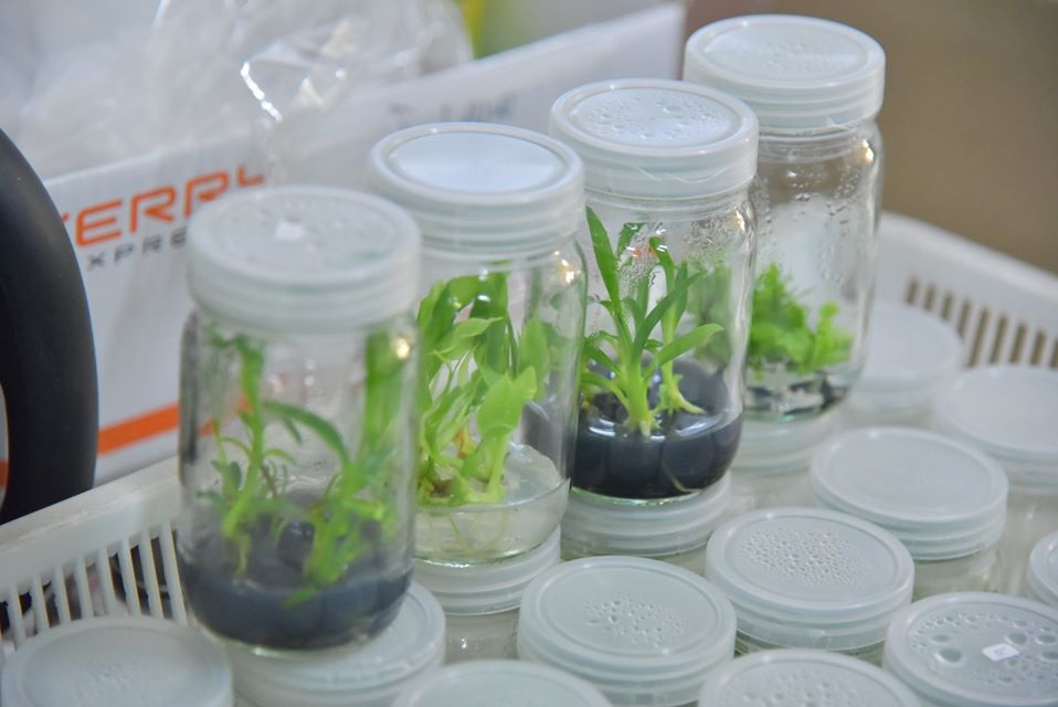
The area, in Mueang Nakhon Ratchasima District, is a nature-oriented school and university research center, consisting of a garden in honor of Her Majesty Queen Sirikit, a natural science museum, and the center for the Plant Genetic Conservation Project under the Royal Initiative of Her Royal Highness Princess Maha Chakri Sirindhorn. The 160-hectare reserve forest is a mix of dry dipterocarp forest and mixed deciduous forest and represents the forests found in the southern part of Northeastern Thailand.
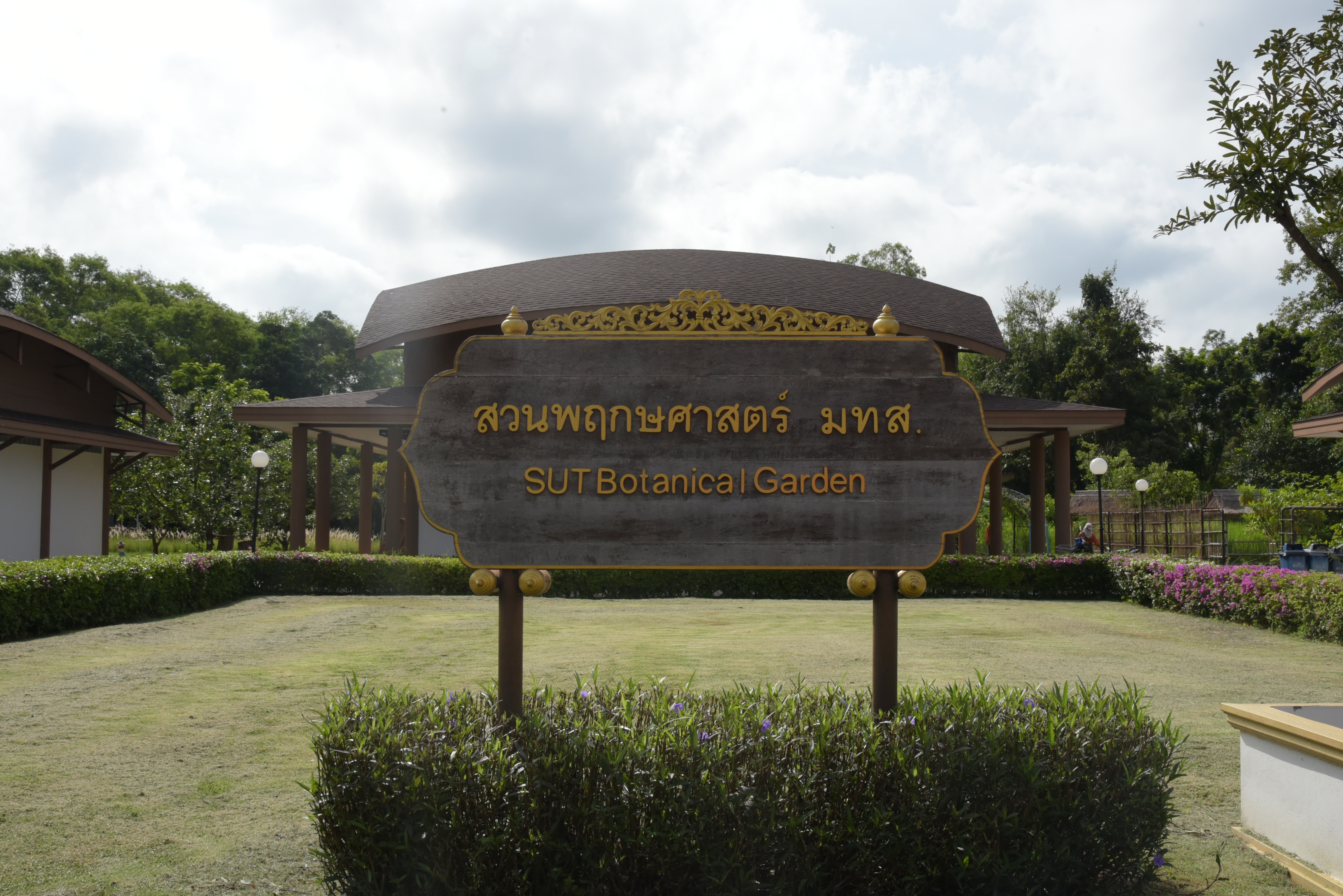
SUT Botanical Garden
Importance: Scientific Educational and Protected
Level: LOC
This botanical garden was started as part of the Plant Genetic Conservation Project under the Royal Initiative of Her Royal Highness Princess Maha Chakri Sirindhorn and is situated on the grounds of Suranaree University of Technology, Mueang Nakhon Ratchasima District. The purposes of the garden are to carry out research and academic service regarding botanical innovations and to display cultivated and wild plants for youths and the general public.
Khlong Phai Plant Genetic Conservation Center
Importance: Scientific, Educational and Protected
Level: REG
This center, part of the Plant Genetic Conservation Project under the Royal Initiative of Her Royal Highness Princess Maha Chakri Sirindhorn, is a station for training and publicizing botanical gardens of participating schools in the northeast and elsewhere. The center includes a nursery of seedlings collected from throughout the country a large amount of genetic diversity. Workshops are held to increase the knowledge of farmers and other interested persons.
(Photo credit https://www.facebook.com/rpsut)
2. Cultural heritage
The geopark has a close connection between geological and cultural heritage. One of the oldest sites of cultural heritage is an assemblage of artifacts (pebble tools, flakes, and scrapers) made of petrified wood from the Palaeolithic (Old Stone Age) that resembles the Anyathian Culture of Burma. Archaeologists have given the name “Sung Noen Culture” to signify the distinctive material for making tools of this culture in Sung Noen internationally valued and published in World Archaeology (Schepartz et al., 2000). For thousands of years, people have lived along and near the Lam Takhong waterway that flows eastward through the geopark as evidenced by the pictographs on sandstone in Sikhio District from 3,000 or 4,000 years ago. Later, sandstone from the Phu Phan and Khok Kruat Formations was used to construct statues Conservation Project under the Royal Initiative of Her Royal Highness Princess Maha Chakri Sirindhorn, which is a station for training and publicizing the work done at the botanical gardens of participating schools in the northeast and elsewhere. The center includes a nursery of seedlings collected from throughout the country representing a large amount of genetic diversity. Workshops are held to increase the knowledge of farmers and other interested persons. 24 and buildings, such as the Reclining Buddha from the Dvaravati period, and Mueang Khaek and Phanom Wan stone sanctuaries from the Khmer Empire. Sandstone quarries used for these ancient constructions can be found in Sikhio and Sung Noen districts. During the Ayutthaya Period, sandstone, laterite, and bricks were used to construct the city walls and gates of Nakhon Ratchasima city. At the present time, many artisans are employed carving statues from local sandstone. Agriculture in the geopark has also been heavily influenced by geological factors, e.g., high-quality pomelos in Sung Noen District can be grown because of fertile soil derived from sandstone; on the dip slopes of the outer cuestas, the combination of the higher altitude, local climate, and soil quality allow growth of low-caffeine coffee, macadamia nuts, and mangosteen.
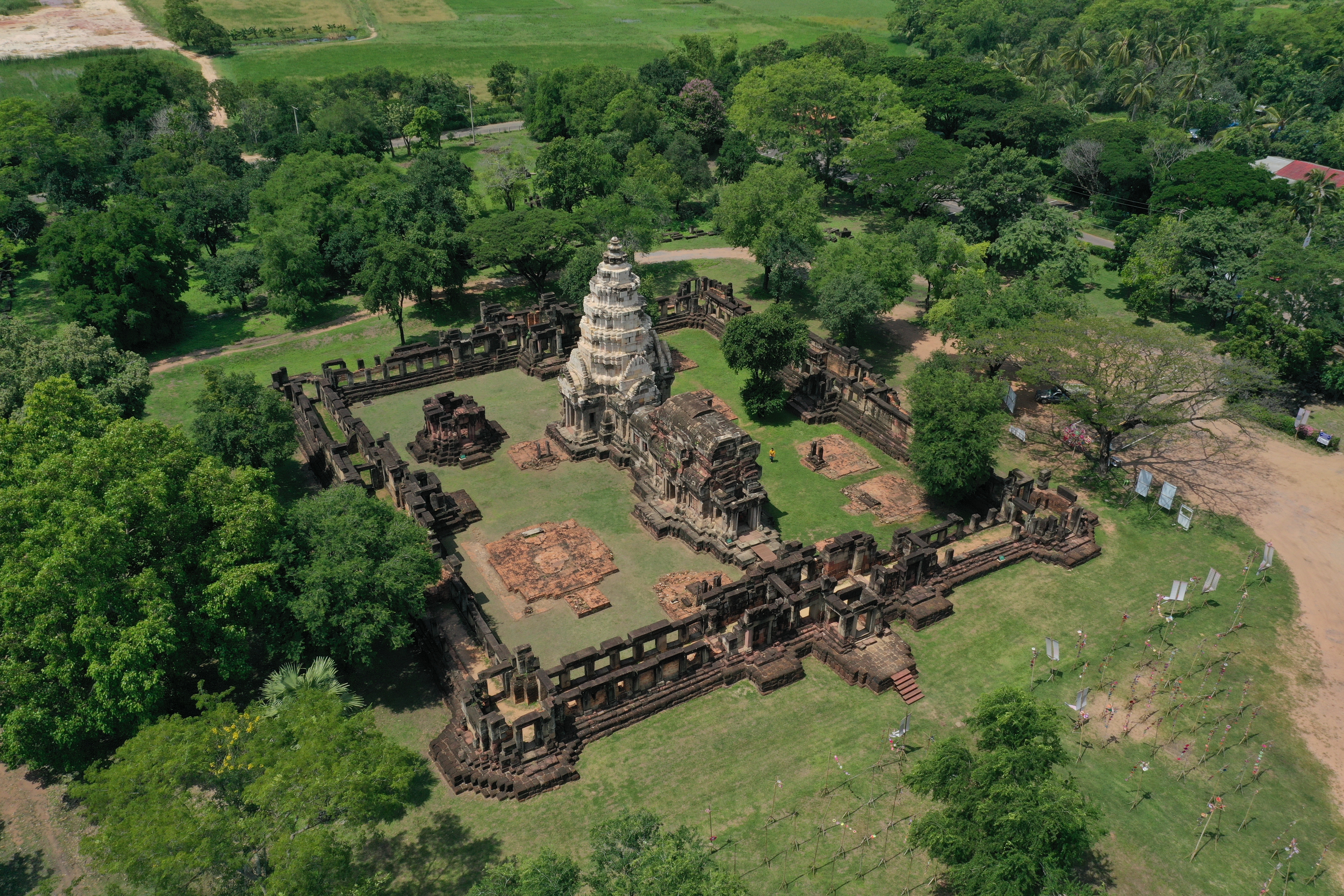
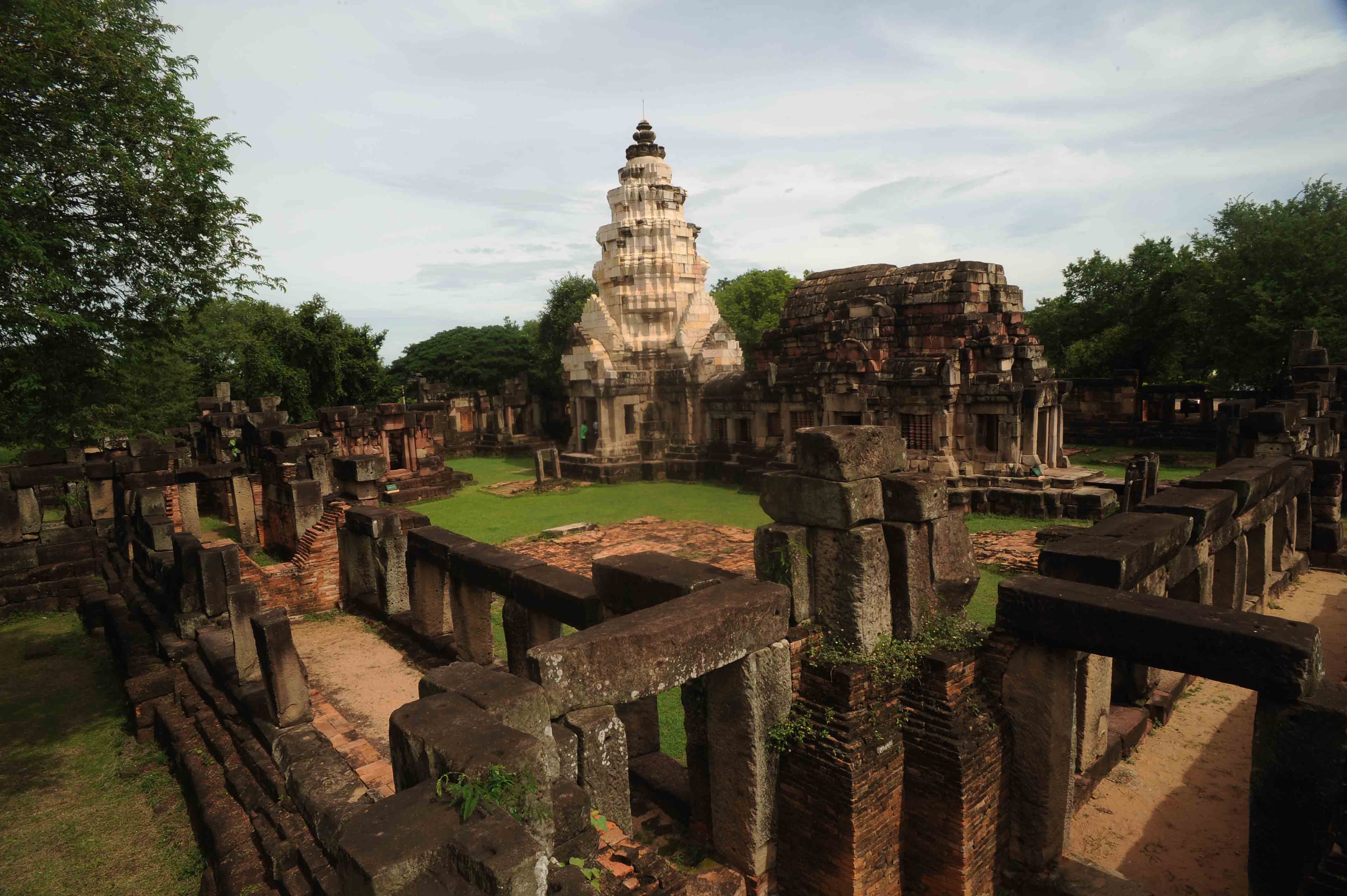
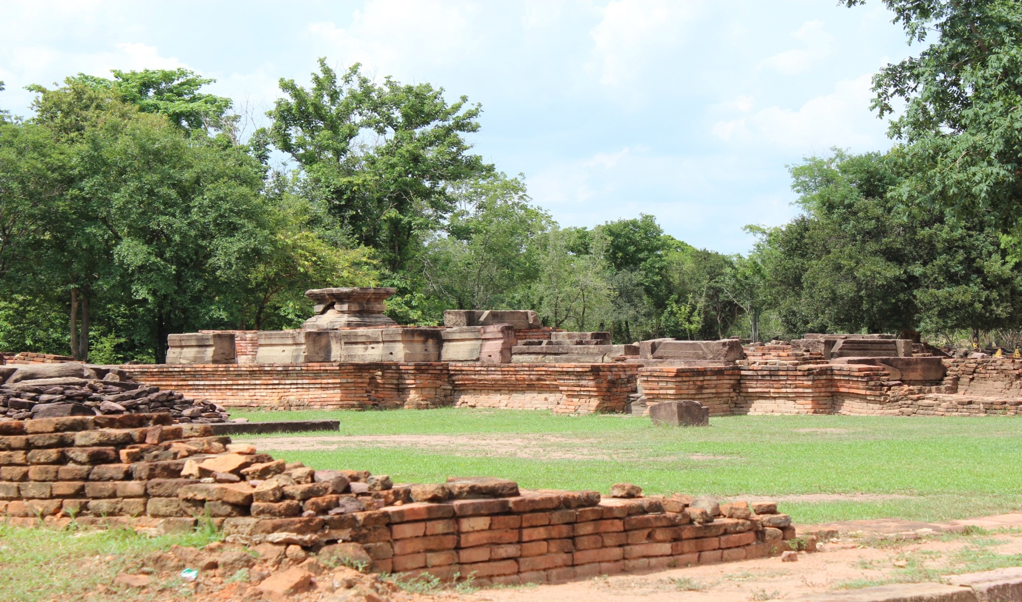
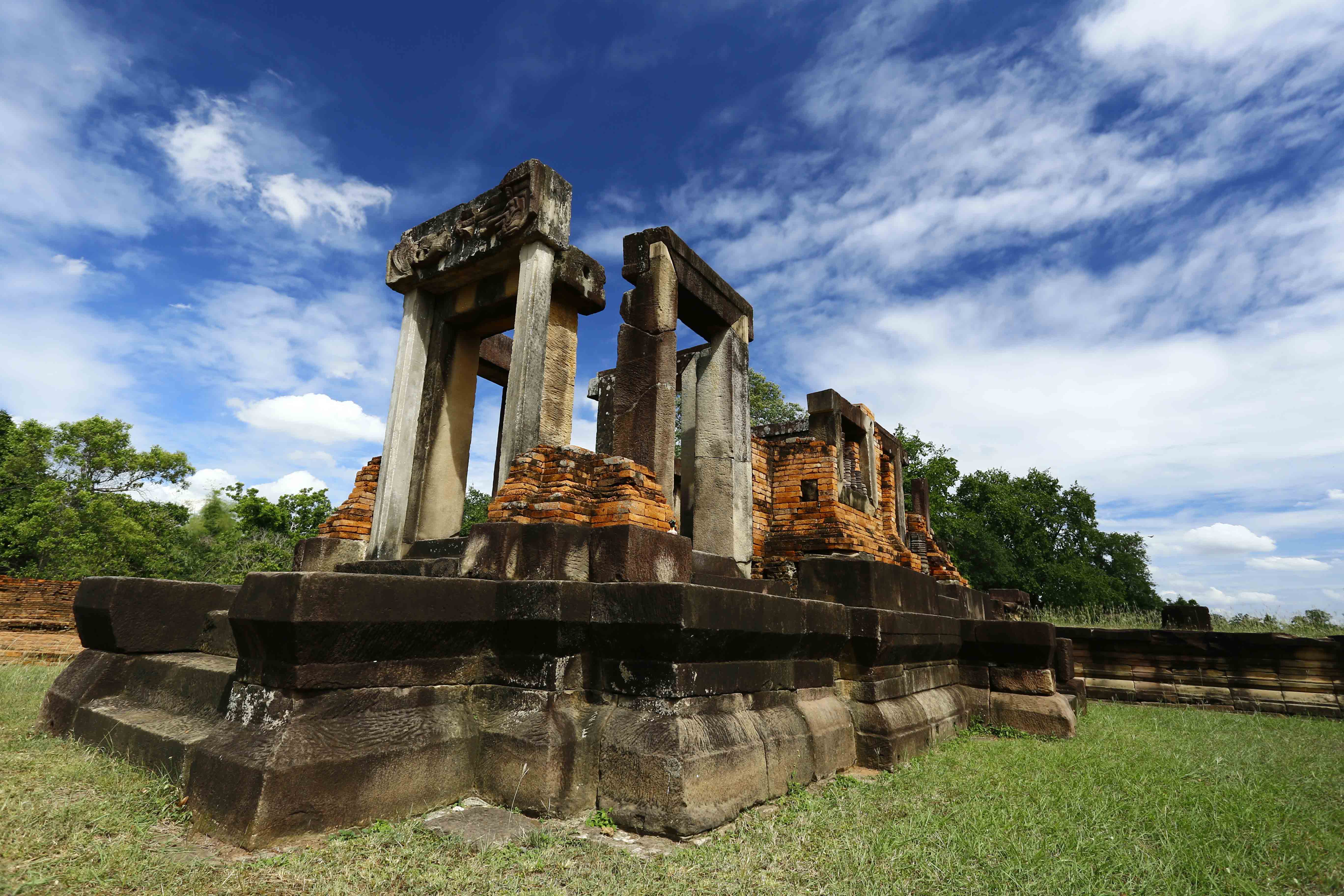
Phanom Wan Stone Sanctuary
Importance: Scientific, Educational, Tourism and Protected
Level: NAT
This stone sanctuary, in Mueang Nakhon Ratchasima District, was first constructed in the 10th A.D. as a brick pagoda. A large pagoda was built on top of this in the 11th to 12th centuries with local white and red sandstone.
Phon Sung Eco-community
Importance: Tourism and Educational
Level: LOC
This village in Muen Wai Subdistrict, Mueang Nakhon Ratchasima District, is a tourist site with the name, “Phon Sung Eco-community City Border Agriculture”. There are homestays and cycling activities along the Lam Boribun and traditional village farms.
Ban Yuan Chaloemraja Cultural Center
Importance: Educational, Tourism Protected
Level: NAT
This site is the source of Thai crafts that have been affiliated with the way of life of Tai Yuan (or Northern Thai) people in the Sikhio District for nearly 200 years.
Chumphon Gate and Thao Suranaree Monument
Importance: Tourism
Level: NAT
A city wall of Nakhon Ratchasima was built during the reign of King Narai the Great (A.D 1656 - 1688), with a width of 1,000 meters and length of 1,700 meters, covering an area of 1.6 square kilometers. Of 4 gates only the Chumphon Gate remains. The city wall is integrally linked with geology as it was built from red bricks, laterite, and sandstone. In front of the Chumphon Gate is a monument of the heroine “Thao Suranaree”.
Ban Som Kob Ngam Sandstone Historical Quarry
Importance: Scientific, Educational, Tourism and Protected
Level: LOC
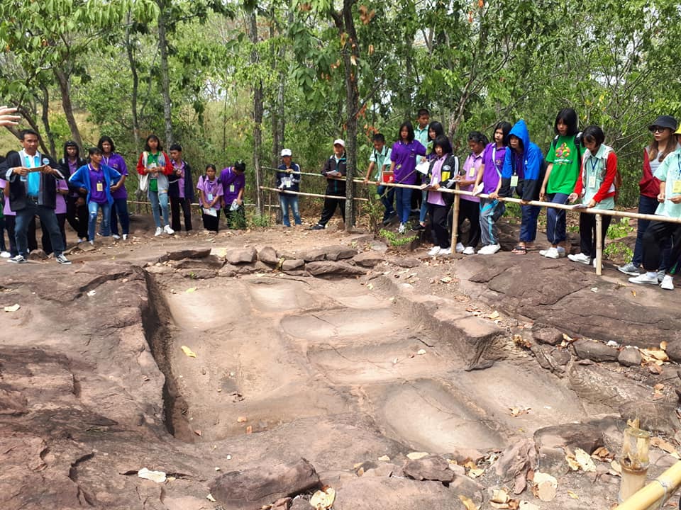
This is a site with dinosaur fossils in the calcareous conglomerate of the Khok Kruat Formation, Early Cretaceous Period (approx. 110 million years before present). Reddish sandstone of this formation exhibits man-made rectangular grooves indicating the use of the sandstone in ancient construction.
Sema Historical City
Importance: Scientific, Educational, Tourism Protected
Level: NAT
Mueang Sema was a large ancient city during the 7th or 8th century A.D. and is thought to have been the center of the Sri Canasapura Kingdom before the Khmer gained control of the E-sarn region.
Dvaravati Sandstone Reclining Buddha
Importance: Scientific, Educational, Tourism Protected
Level: NAT
This largest and oldest sandstone Reclining Buddha image in Thailand was built more than 1,300 years ago from blocks of red sandstone, about the same time as the ancient city Mueang Sema of the kingdom of Sri Canasapura

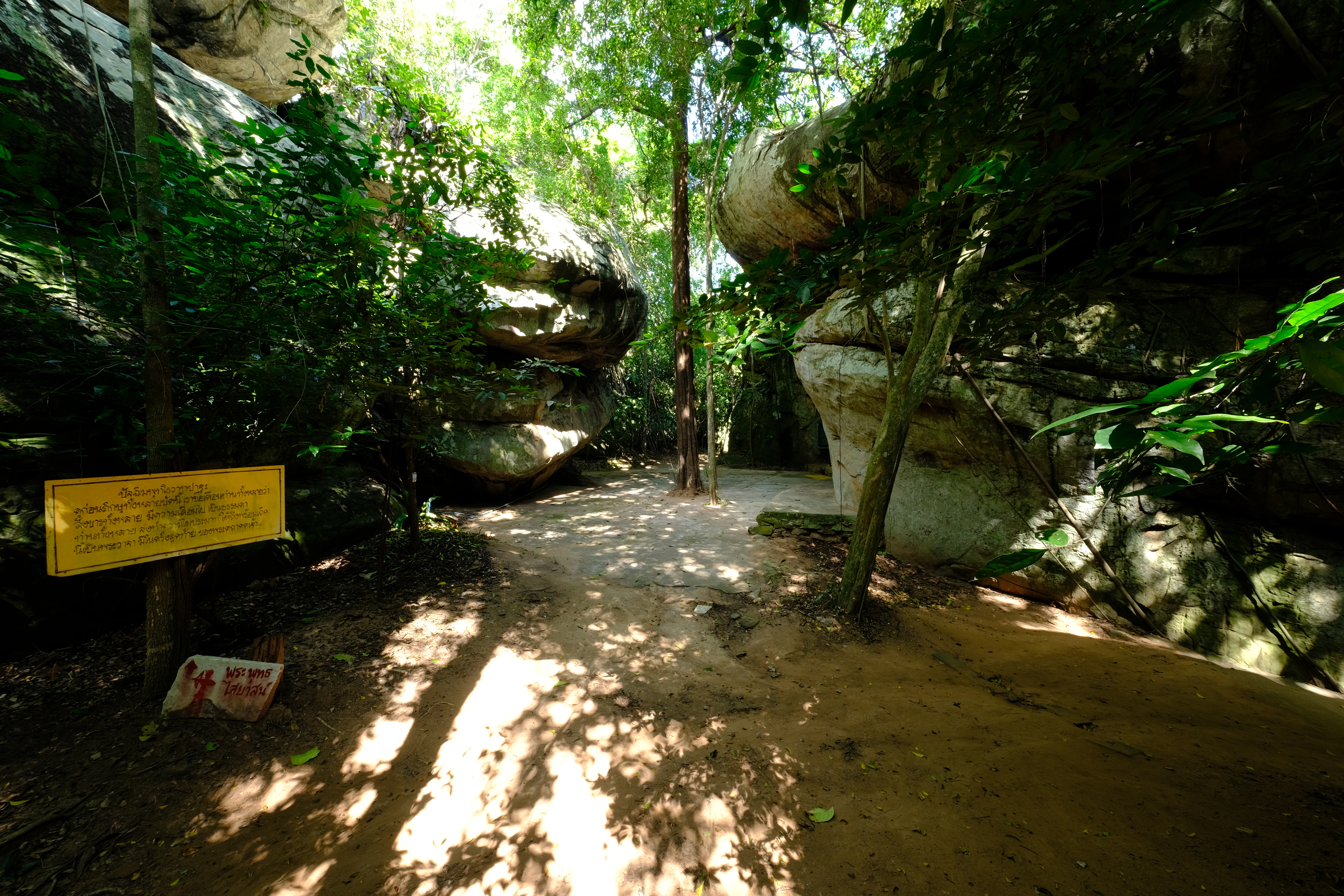
Khao Chan Ngam Cave & Prehistoric Paintings
Importance: Scientific, Educational, Tourism Protected
Level: NAT
This is an important site for geology, especially for studying the sedimentary structure and morphology. The site showcases pictographs from the Neolithic period (approx. 3,000 – 4,000 years before present) that indicate the way of life of Khorat ancestors and includes protected dry evergreen forest.

Sikhio Sandstone Historical Quarry
Importance: Scientific, Educational, Tourism Protected
Level: NAT
A resource site of sandstone used for the construction of stone sanctuaries and other important structures in the Khorat Geopark.

.jpg)
Mueang Khaek Stone Sanctuary
Importance: Tourism, Educational and Protected
Level: NAT
This site is a Khmer Hindu or Brahman religious complex that was built in approximately 974 A.D from sandstone and bricks. The site was used for ritual offerings to Shiva.
Nam Cha Market
Importance: Tourism
Level: LOC
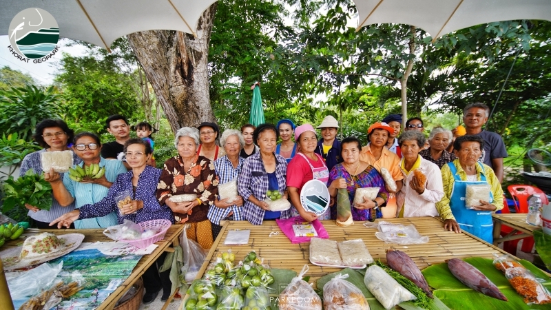
This market is located along the Lam Takhong, in Pong Daeng Subdistrict, Kham Thale District. The market reflects the way of life of the local community.
3. Intangible heritage
Intangible heritage is prominent within the everyday lives of many locals living in the Khorat Geopark. Local customs and traditional knowledge remain intact within most villages and rural communities even with the increasing prominence of westernization that is seen in major cities.
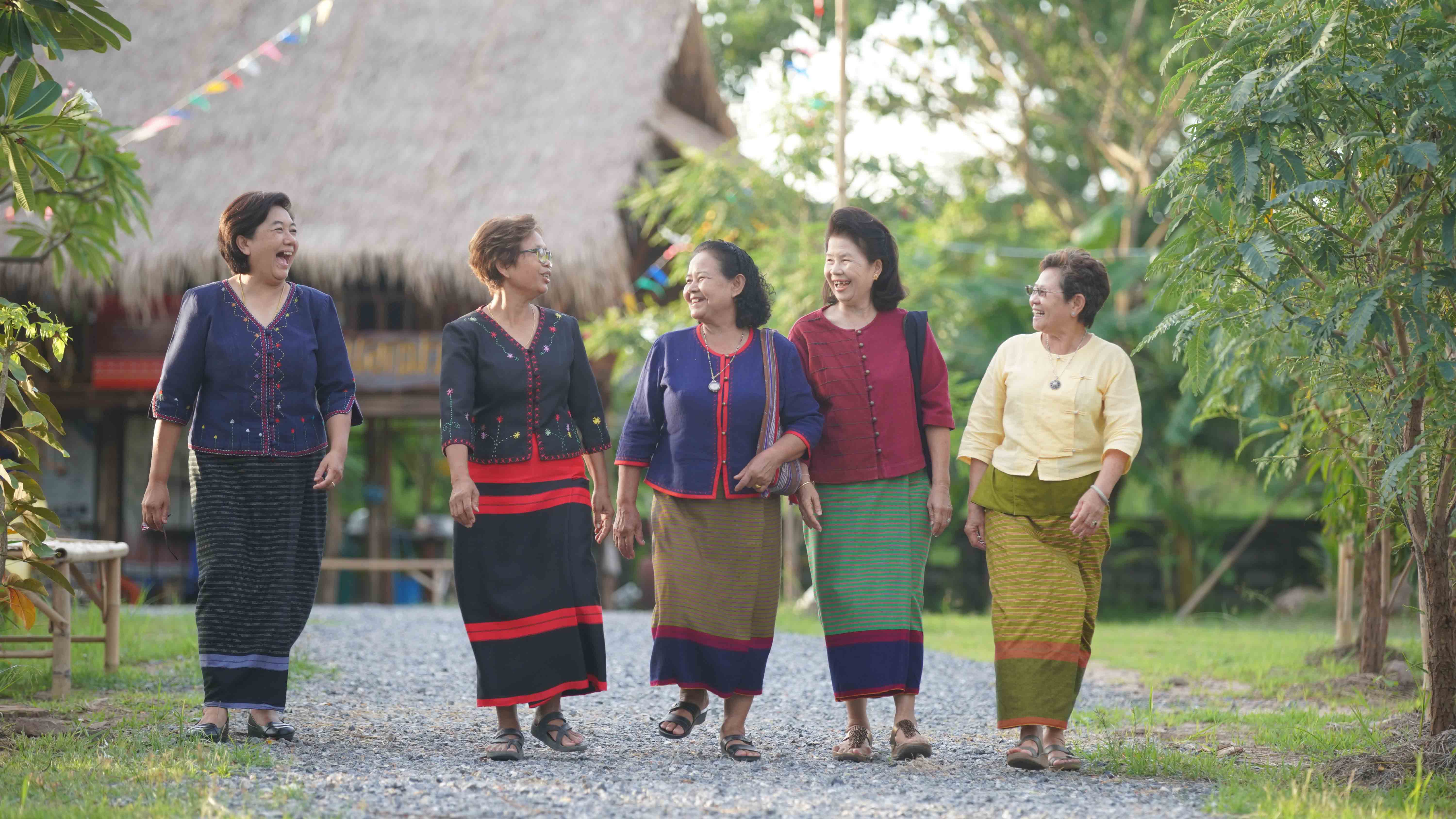
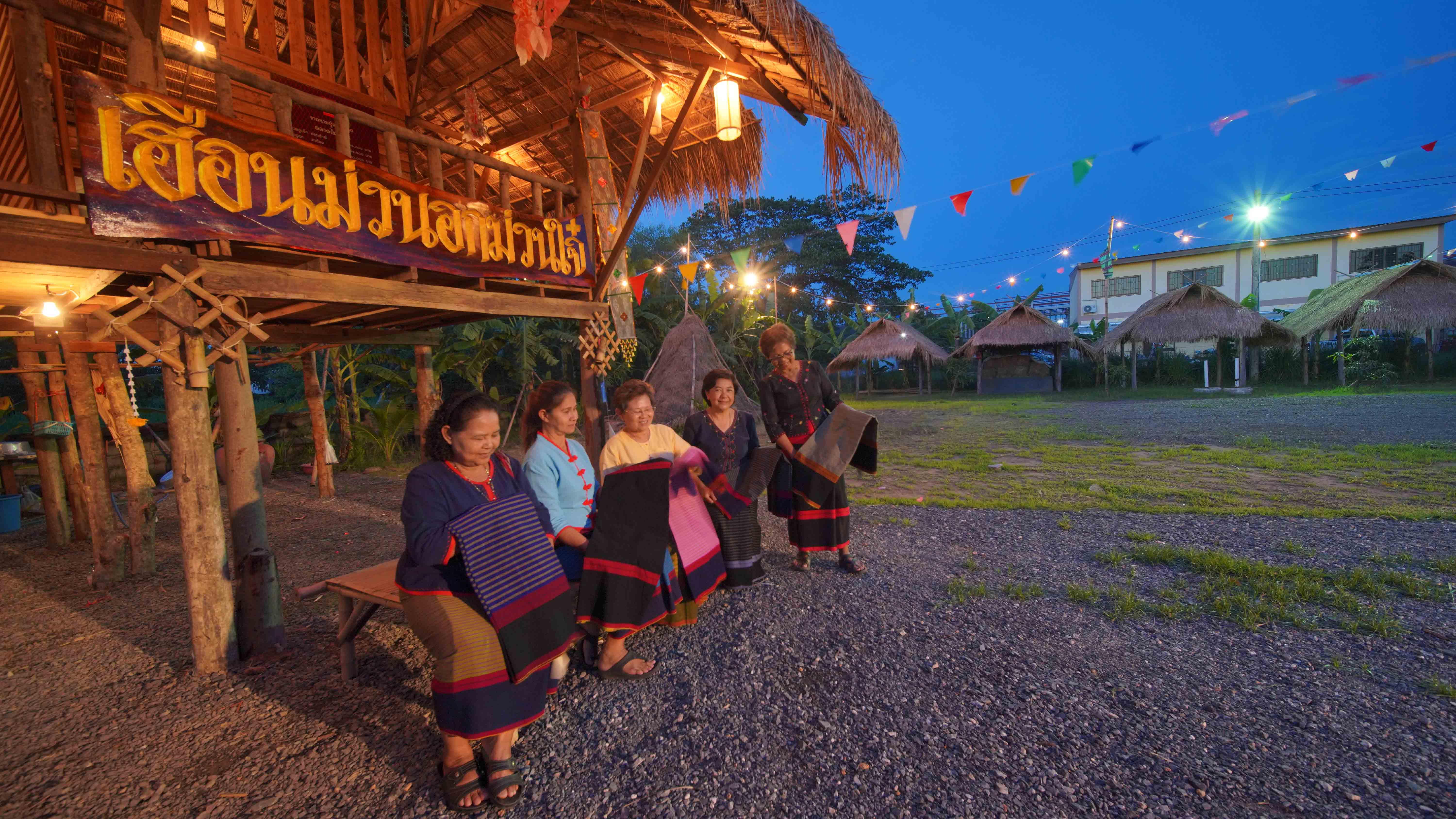
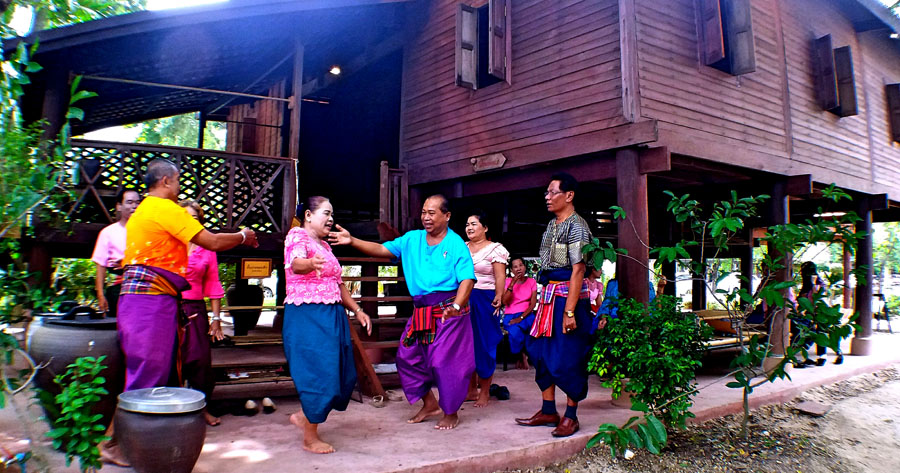
1) The native language in Khorat has similarities to central Thai but differs in accent and some words. The culture and beliefs on the Khorat Plateau are slightly distinct from those on the central plain. For example, the Khorat Song (Phleng Khorat) iconic to the Khorat community which uses local Khorat terms in their folksong and lyrics imply a belief in the supernatural and religious faith in the concepts of Karma-laws of moral causation (Kongwaree, 2013). The region has six ethnic groups: Khorat Thai, Esan Thai, Chinese Thai, Muslim Thai, Sikh Thai, and Yuan Thai, each with their own words, costumes, songs, traditions and cultures. Tai-Yuan traditional weaving skills. These Northern Thais inherited and preserved the traditions, customs, and arts of their ancestors, including the craft of weaving, most notably, weaving of the Pha Sin traditional dress. Weaving is practiced within individual families, and the detailed, beautiful cloth produced is known as Pha Yuan, meaning the cloth of Thai-Yuan people. Visitors can go to Ban YuanChalermraja Rat cultural center and market to learn about their traditional lifestyle in Sikhio District. Tai-Yuan culture has been passed down in Sikhio District for nearly 200 years. The ancestors of these people lived in the city of Chiang Saen at the northern border of Thailand, then called Yonok City. A conflict between Siamese and Burmese forces caused a group of Yonok City inhabitants to move to and build a settlement in Saraburi and Chan Thuek (the present Sikhio). Ngieng Nang Dam Textile Weaving Since the establishment of Sung Noen District more than 100 years ago, Ngieng Nang Dam cloth has been characterized by cotton, twined with 3 varying colors twisted together into a single colorful pattern. When weaving, there are 3 textile patterns used. The first is red cloth matched with vertical stripes of yellow and white; the second is indigo dyed cloth inserted with red yarn; the third is a fringe layer of the sarong woven with a striped cloth. The cloth is worn as a sarong in daily life by Sung Noen people. However, the material can also be woven from fine silk and is worn during special occasions such as religious ceremonies. The cloth is available at Ngieng Nang Dham Production Site, Sung Noen Municipality, Sung Noen District. Pong Daeng sustainable agriculture lifestyle. At Nam Cha Market villagers sell a large variety of vegetables, fruits, and wild food products from what they harvest every morning, reflecting the traditional way of life of the community of Pong Daeng Subdistrict, Kham Thale So District. A portion of local food that has achieved fame is Mi Nam Cha, a noodle dish prepared in various ways.
2) The aforementioned heritage is valued at the national level. None of them are recognized by other UNESCO Programmes.
Picture 17 Pleng Korat singers at Ban Korat Museum, Korat Museum, Mueang Nakhon Ratchasima District (left)
(Photo credit: http://www.koratmuseum.com/bankorat.html)
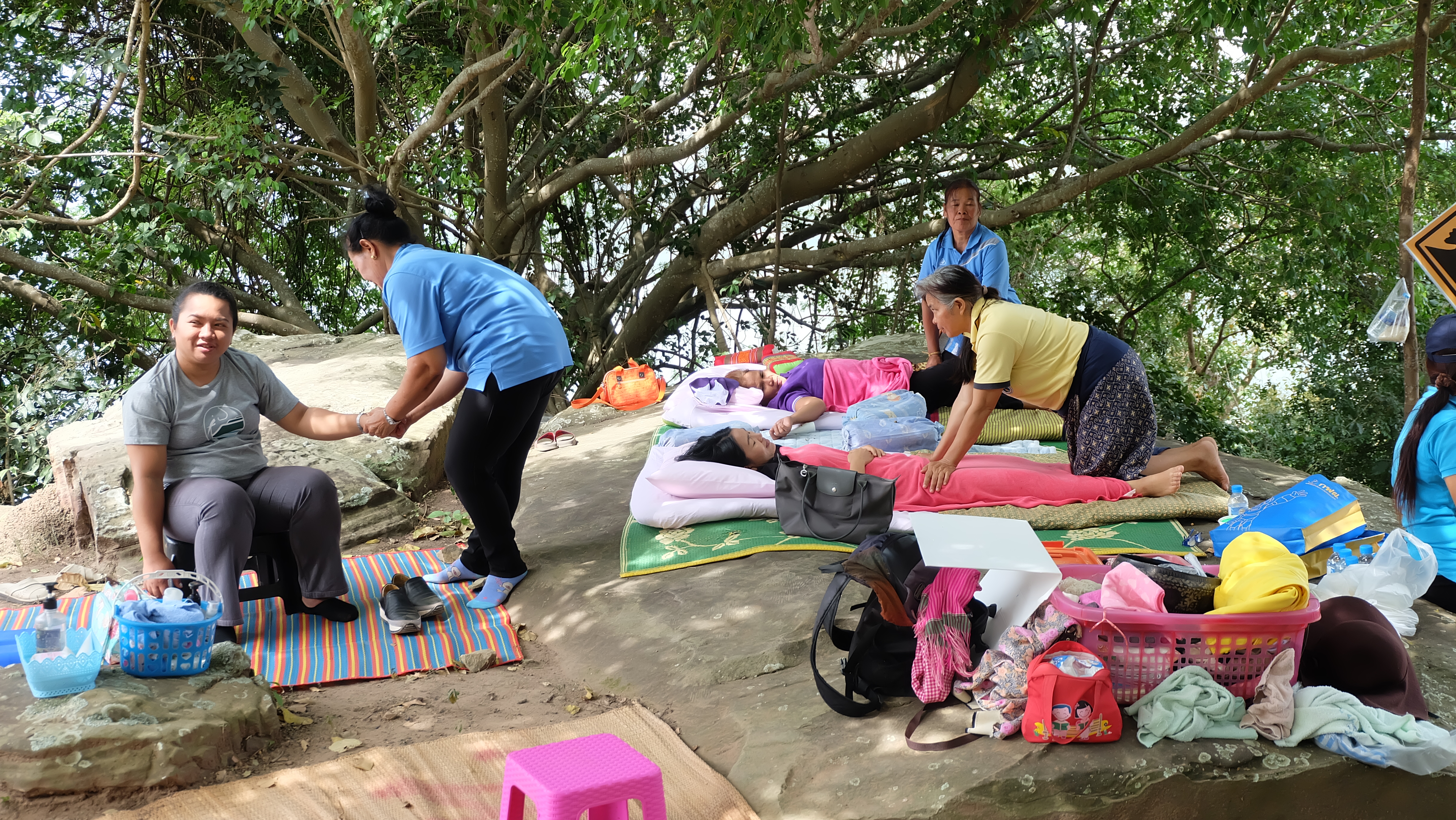
Picture 18 Pha Yai Thiang Village Thai Massage (right)
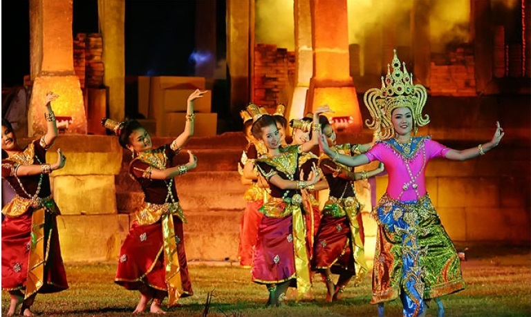
Picture 17 Provincial fair, Kin KhaoKam (Traditional dinner) and Thai dancing at Prasat MueangKhaek, Sung Neon District
4. Involvement in topics related to climate change and natural hazards
1) In the Khorat Geopark there are a number of activities aimed at reducing global climate change through reforestation projects. In the Pha Yai Thiang area of Sikhio District, there are several sites where tourists can use slingshots to re-seed the area with a variety of native tree species. The activities allow visitors to learn about and contribute to forest conservation and reforestation in the area. Furthermore, several sources of renewable energy, including the largest wind power production lant in Thailand, are located within the Geopark boundaries; solar power is also produced in various locations. hazards, with no active volcanoes and little to no risk of earthquakes. However, flooding during the rainy season can pose a serious issue in the geopark. Factors contributing to the flood risk include the expansion of the city preventing the flow of water and shrinking of the drainage area, resulting in sudden flooding in the western area of the park. Heavy rainfall coupled with water flowing down from the cuestas has led to major flooding in the lowlands. The loss of natural habitats through agricultural intensification and urban development exacerbates the issue. Rockfalls present another risk in the geosite. The more resistant upper sandstone layers of the cuestas are undercut by the erosion of the underlying softer sandstone, leading to falling rocks. To combat flooding and rockfall issues, regional communities have participated in workshops to disseminate knowledge on strengthening community network security systems. The Nakhon Ratchasima government in partnership with the Department of Mineral Resources conducted a workshop on 24 July 2018, for the communities in the Khlong Phai Subdistrict, Sikhio District, in the foothills of the Khorat cuesta. The goal was to reduce damage from disasters, such as floods, landslides, and rockfalls, and provide suggestions for monitoring future events to cope with potential hazards and damage.
2) Khorat Geopark sites along with other areas within the Geopark occasionally face flooding. Actions undertaken to mitigate this hazard are mentioned in 1) above.